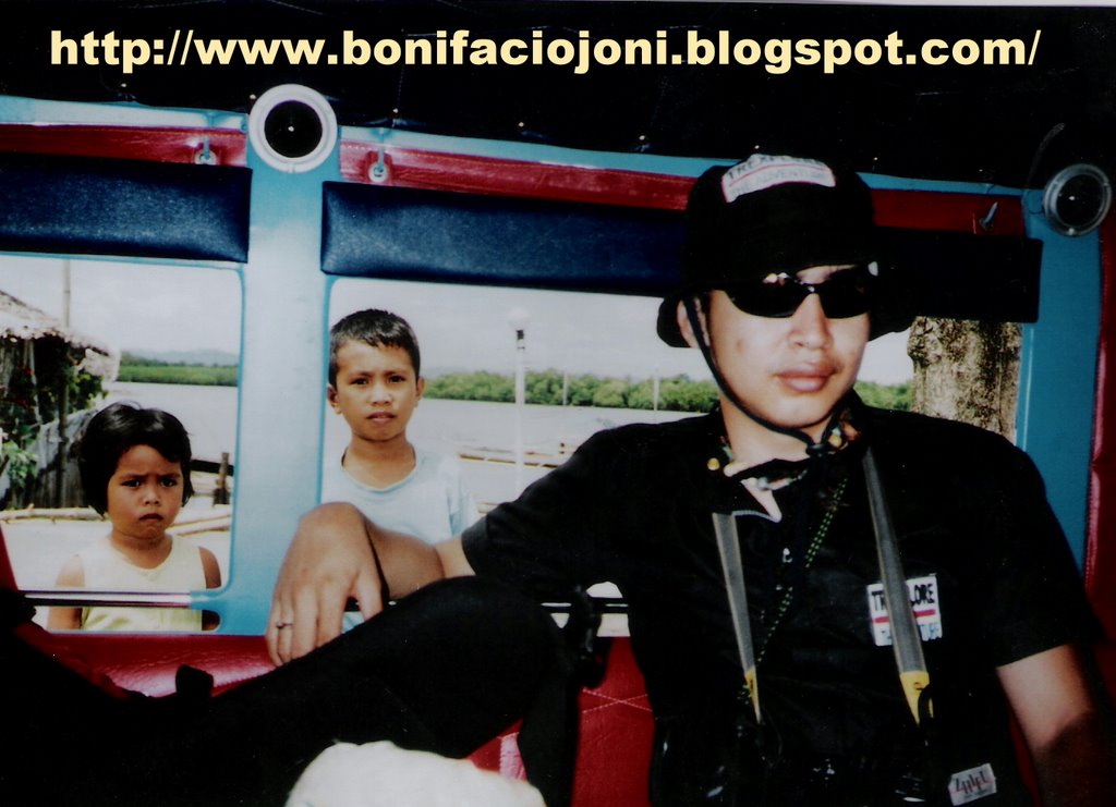
SAMAR ISLAND GUIDE: EXPLORER JONI A. BONIFACIO TEL: 055-2512301
CELL:09192943865 / 09053233572
WEBSITE: www.bonifaciojoni.blogspot.com
CANYAWA CAVING EXPEDITIONS 2002
CALBIGA,SAMAR PHILIPPINES
MARCH 16,2002 TO APRIL 20,2002
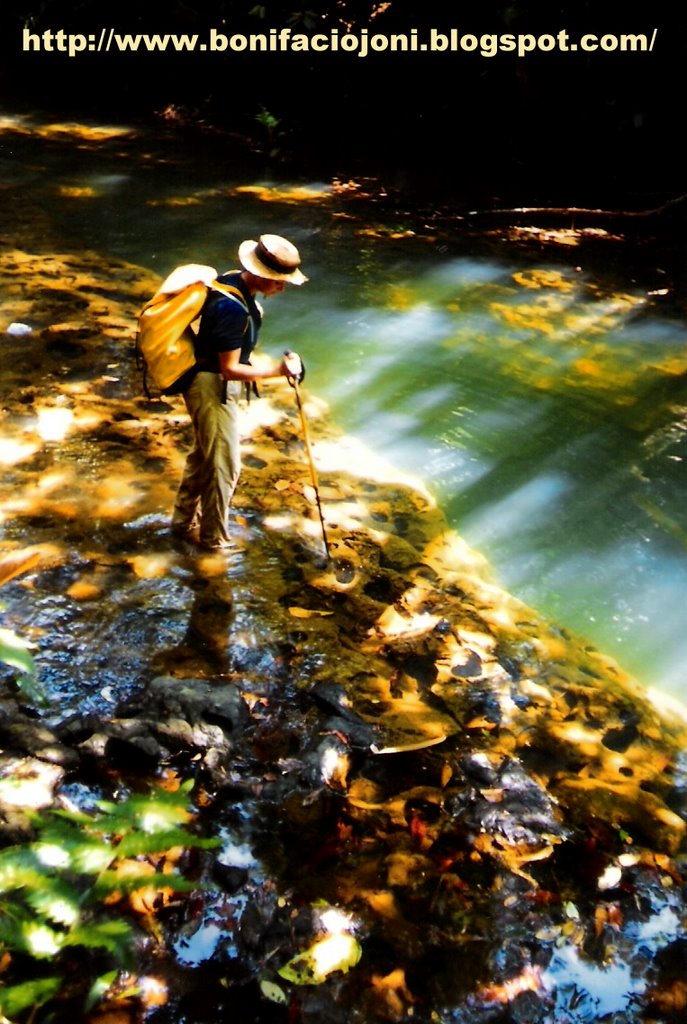
PHOTO BY : MR. JEAN PAUL SOUNIER

MR. JEAN PAUL SOUNIER (FRENCH CAVER)
Team Leader,Canyawa 2002 Expeditions
The French Caving Expedition Team
175 Chemin de Beauvert 06600 Antibes
Email: Sounier@club-internet.fr

MR. JONI A. BONIFACIO (FILIPINO CAVER)
Trexplore The Adventures
Abesamis Store Allen Ave. Catbalogan,Samar
TEL: 055-2512301 CELL: 09192943865
Email: trexplore@yahoo.com
Website: www.bonifaciojoni.blogspot.com
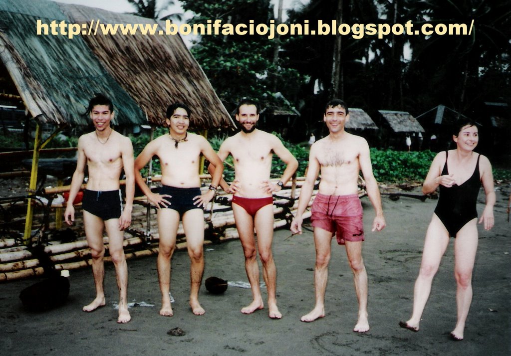
CAVING EXPEDITION TEAM:
1.Jean-Paul Sounier (leader and photographer/French Caver)
2.Philippe Audra (karst specialist/French Caver)
3.Paul Courbon (surveyor/French Caver)
4.David Hiou You (equipment coordinator/French Caver)
5.Catherine Caullier (French Caver)
6.Christine Le Roch (French Caver)
7.Laurent Jovet (French Caver)
8.Philippe Hache (French Caver)
9.William Michel (French Caver)
10.Luc Ruyssens (French Caver)
11.Joni Bonifacio (Trexplore/Filipino Caver)


CANYAWA CAVING EXPEDITION 2002
Page 1 of 11
CAN-YAWA 2002 EXPEDITION REPORT
WESTERN & EASTERN SAMAR ; SAMAR ISLAND, PHILIPPINES
March 10th – April 28th 2002
This report includes results from SURIBAO 2000 caving expedition
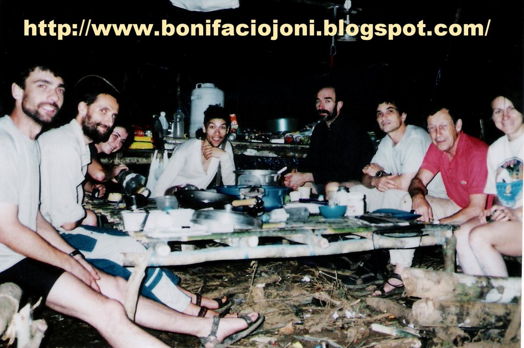
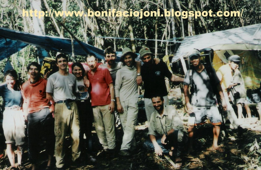
EXPEDITION MEMBERS
Jean-Paul Sounier (leader and photographer)
Philippe Audra (karst specialist)
Paul Courbon (surveyor)
David Hiou You (equipment coordinator)
Catherine Caullier
Christine Le Roch
Laurent Jovet
Philippe Hache
William Michel
Luc Ruyssens
Joni Bonifacio
Written by Administrator
Monday, 21 March 2005
Page 2 of 111. EXPEDITION OBJECTIVES
The expedition main objective was the carrying out of the exploration of Can-Yawa cave, and above all, the active part. The visit of other objectives spotted on the map were depending upon the results in Can-Yawa cave. In case of important discoveries in Can-Yawa, all the team energy would be spent in exploring its new parts.
In Can-Yawa cave, the streamway was the most promising objective. The underground river could lead us to the resurgence, but also enable us to join the underground course of the Mactingal river, probably the main drain of the plateau. The second objective in Can-Yawa was to be able to find a way past the boulders choke in « No Future » chamber.
The objectives spotted on the map were :
· The sinkhole of a river located 4 km, south-southeast from Can-Yawa cave. This underground river could re-appear in Kulindungan, the name of the Calbiga spring. It would mark the southern limit of the catchment area.
· A dry valley located above the extreme point reached in Can-Yawa streamway. A cave located in the western part of this valley could communicate with Can-Yawa underground river, downstream the sump. The path used by the Elf Authentic Adventure runners follows this dry valley.
· The western end of a dry valley located 3 km north from Can-Yawa entrance. This dry valley could be an ancient bed of the Mactingal river. The valley heads west and ends as a blind valley.
· The sinkhole of the Mactingal river. Several Italian expeditions tried to reach it but without success due to the NPA based on the western flank of the karstic area. To reach it was doubly interesting. The importance of the catchment area and stories about a 200 m large entrance porch let supposed a huge underground network. To have a look of the area could also enable us to find an objective for a future expedition.
Several scenarios were dreamed up in order to reach these objectives and carrying out at the same time the exploration of Can-Yawa. Set up the camp at the same place as two years before and walk from it, the access at the Mactingal sinkhole being on the surface of the plateau. In case we could connect Can-Yawa to the Mactingal underground course, the exploration could be done by establishing underground camp. Or, move the camp from Can-Yawa to the bank of the Mactingal river. This scenario meant an important portage at mid-stay. But what happen really was different from the above planning.
CHRONOLOGY OF THE EXPEDITION
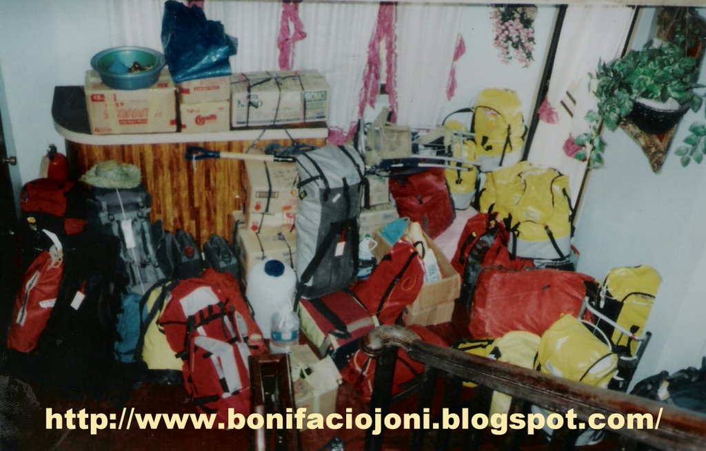
March 10th Departure from France on March 10th with Lufthansa Airlines that we should like to thank for allowing an 8 kg per person excess weight.
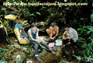
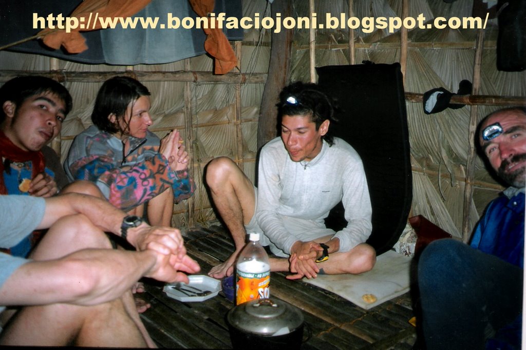
From March 13th to March 15th : organising the trip in Tacloban. Arrival of Joni Bonifacio.
March 16th travel in jeepney from Tacloban to Borongan, Eastern Samar.
March 17th Pompei comes to visit us; we all go to see Borongan Mayor.
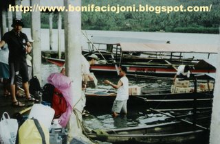
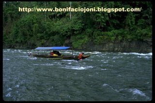
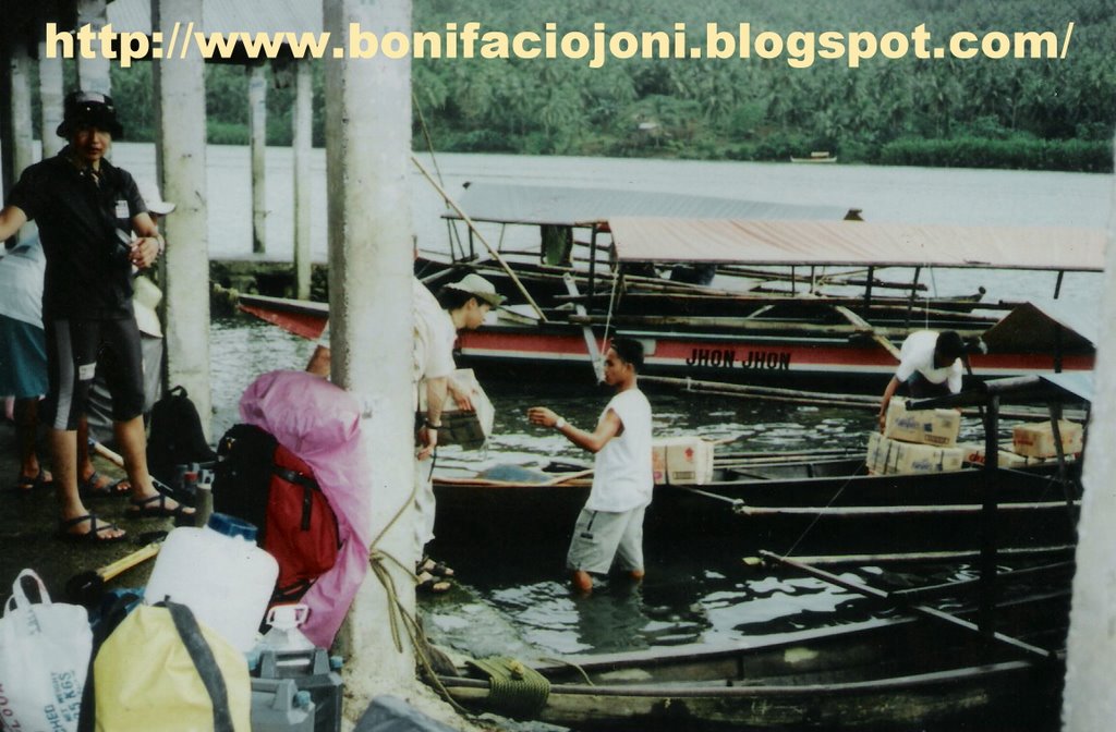
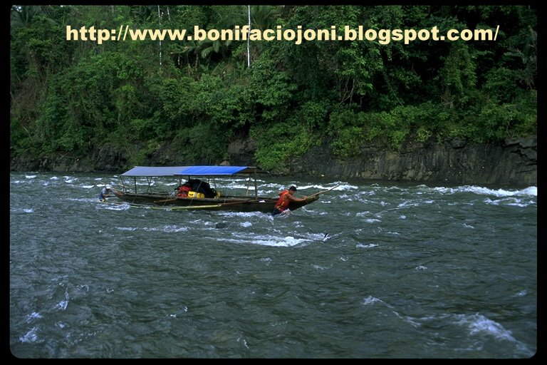
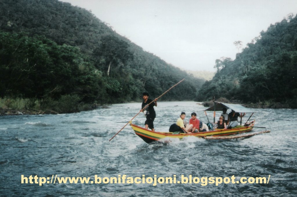
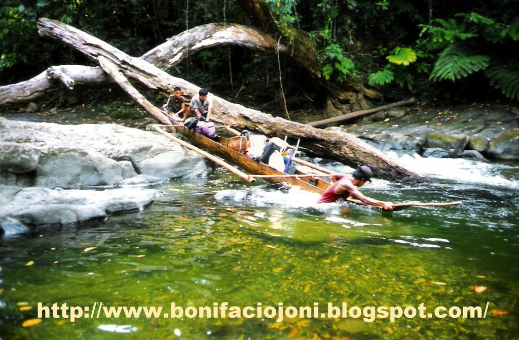
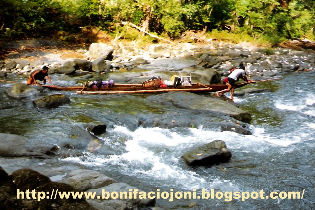
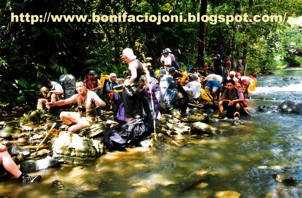
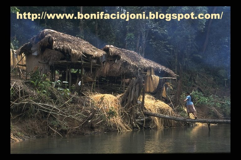
March 18th With Abdel Elecho, we go to see the Mayor who signs the official authorizations. Then we go to Pompei’s office then to the DENR. At 9.30 am, we go to Camada. Trip up the Suribao river to Bagong Barrio, with stop-off in Pamaragsangan to see the military commander and Binuangna to change bancas.
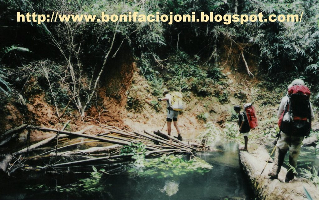
March 19th departure from Bagong Barrio at 9.15 am. The team and 44 porters reach San Isidro at 4.30 pm.
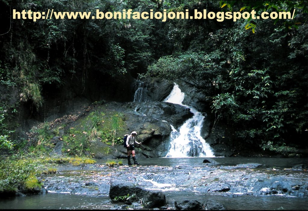
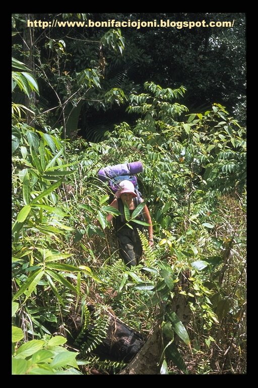
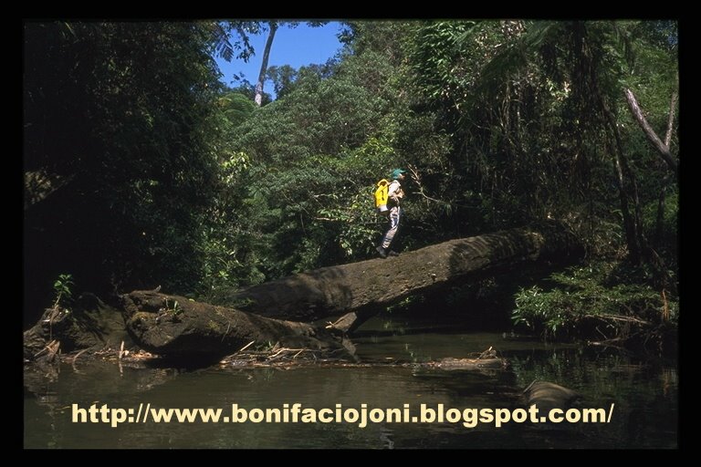
March 20th departure from San Isidro at 9.30 am. The bamboo zone located west of Mount Asgad slows down progress as the path has been swallowed by the thick vegetation. We set up a bivouac near a river.
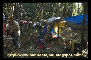
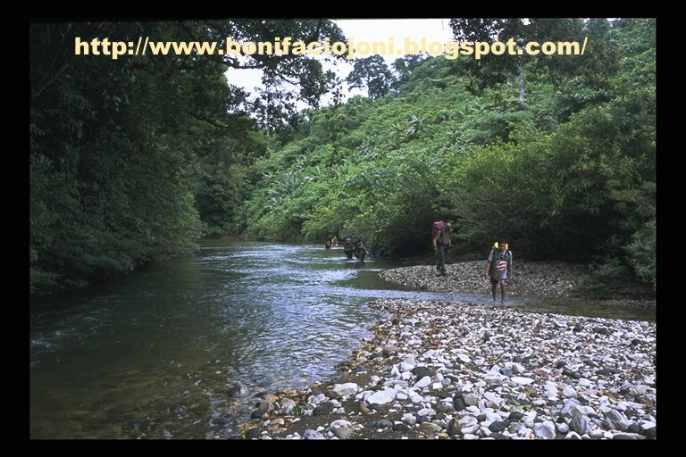
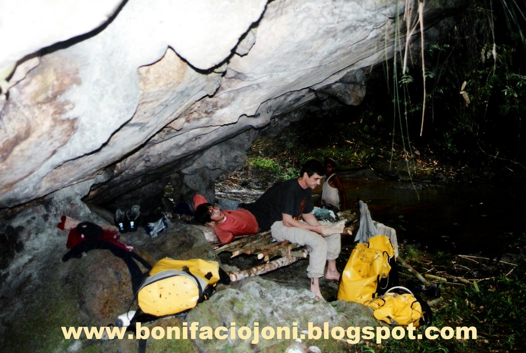
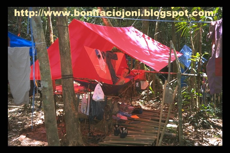
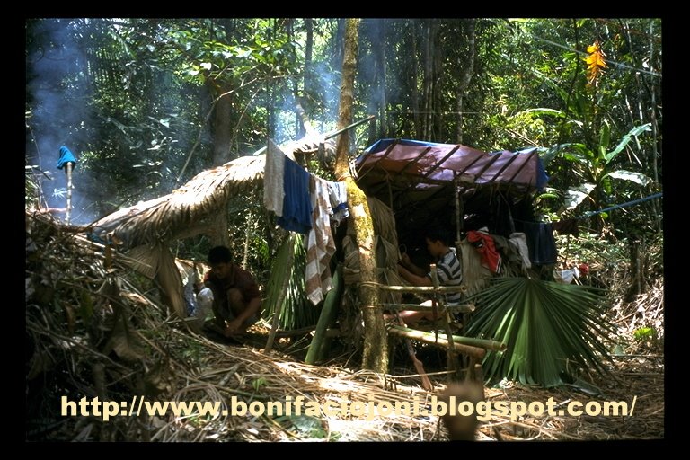
March 21st departure at 7 am. We reached the Suribao expedition camping site at 11 am. Set up of the camp.
March 22nd it rains heavily. Can-Yawa river is flooding. We carry on the setting of the camp.
March 23rd the whole team go to Can-Yawa. But the short cut has to be clear up again. So a part of the team visits the cave, while the others cut the track back to the camp.
March 24th exploration of downstream Can-Yawa. We stop on a waterfall due to lack of rope.TSU (Time Spent Underground) : 9h.
March 25th David, Laurent and Cathy carry on the exploration downstream. They reach a big chamber and stop when the gallery roof seems to plunge in the water. On the way back, the river is flooding and they have to fight their way out.TSU : 12h.
March 26th Luc, Christine, Philippe and Jean-Paul go to the « No Future » chamber area. They find a way past the rockfall at the end of « No Future » and explore a large gallery (Return to the Future ). Siphon and rockfall stop the progress in this branch which could lead to a western entrance, north from Day cave. In the Rotten Feet river, they stop on a low ceiling gallery.TSU : 15h.
March 27th David and Paul cut a trail towards the southern river.
March 28th Laurent, Cathy and Roderic cut a trail towards the Northern tributary. Paul, David and Jean-Paul explore Can-Yawa downstream. They stop on a sump. They explore a dry tributary on the right bank of the « Clue ».TSU : 11h.
March 29th Luc, Laurent, Cathy and Joni reach the Northern tributary, upstream its sinkhole. Exploration of Jolo cave.TSU : 1h.
March 30th Luc, Philippe and Jean-Paul go to the Northern tributary and reach the San Isidro-Kaamlongan trail.David, Cathy, Paul and Joni cut the trail to the Southern river.Roni and Roderic go to Bagong Barrio to call the porters for the departure of three of us.
March 31st Laurent, Luc and Christine survey Jolo cave. Return of the group who cut the southwards trail. They didn’t reach the river yet.TSU : 2h.
April 1st Cathy and Philippe go to the Northern tributary for sampling. Laurent, Christine, Luc and Jean-Paul check some caves openings located near the track going to San Isidro. They are located southeast from the camp. The caves turn out to be parts of old cave systems which are destroyed by erosion.
April 2nd Laurent, Cathy and David leave the camp. Philippe, Christine and Jean-Paul go to the area located above Can-Yawa sump to look for caves in the hope to find a way downstream the sump.TSU : 2 h.
April 3rd rest.
April 4th Philippe, Paul, Christine and Jean-Paul go to the Southern river and reach the sinkhole area. They explore 3 caves. Back to the camp at 2 am the next day.TSU : 4 h.
April 5th arrival of Philippe Hache and William Michel.
April 6th Philippe Hache, William and Jean-Paul go to check the end of the dry valley located north from Can-Yawa cave. They reach the end of the dry valley at 4.30 pm but no caves are found.Paul and Philippe go to the big chamber, downstream the “Clue”, and find a new entrance (Elfes cave). They return to the camp through the Mog-Ur.
April 7th Philippe, Willy and Jean-Paul are back to the camp.
April 8th departure of Philippe Audra and Roni who carry one of his bag.
April 9th Willy, Philippe, Luc, Christine, Joni and Jean-Paul go to Can-Yawa for the photo trip. They decide to go through the Anguish tunnel and are surprised by the low level of water. The surprise is at its utmost when they discover a tributary on the right bank of the tunnel, just before the Verdon. They explore about 1 km of galleries. They name this network the tributary of the Last Day. No survey is made because nobody took the gear. The photo trip is made until the « Clue ». William and Philippe go to see the sump.TSU : 13 h.
April 10th departure of the team. It rains all the way long. The team reach San Isidro at 4.30 pm.
April 11th Roni and Roderic guide the team to the sinkhole of the Minaalo river, located northwest from San Isidro. Quick visit of the cave.TSU : 2 h.
April 12th Willy, Luc, Joni and Jean-Paul explore Minaalo cave and traverse the mountain.TSU : 2 h
April 13th Willy, Joni, Jean-Paul and 3 porters including Antonio, San Isidro barangay captain, go to the Mactingal sinkhole. They walk 5 hours and reach Mactingal river.
April 14th Willy, Joni and Jean-Paul visit several Mactingal sinkholes and explore Mactingal cave. Two local farmers guide them.TSU : 2h30.Philippe, Christine, Luc and Paul survey Minaalo cave and explore the beginning of the tributary.TSU : 9h.
April 15th guided by the two local farmers, Willy, Joni and Jean-Paul explore Ninando cave, located northeast from the main Mactingal sinkhole.TSU : 4h30.Luc, Philippe and Paul explore and survey the tributary in Minaalo cave.TSU 7 h.
April 16th Willy, Joni, Jean-Paul and the 3 porters are back to the camp.
April 17th Luc and Paul survey in Minaalo cave.TSU : 5 h.
April 18th Roni and Roderic go to San Isidro to organize the return trip. Philippe, Christine, Joni, Willy and Jean-Paul realize a photo trip in Minaalo. They survey a part of the tributary river.TSU : 6 h.
April 19th return of team to Bagong Barrio. Departure from Minaalo at 7.30 am. Arrival in Bagong Barrio at 6 pm.
April 20th return to Borongan.
April 21st – 22nd : rest in Borongan . Visit to the DENR and the Mayor.
April 23rd return to Tacloban.
April 24th stay in Tacloban.
April 25th Philippe, Christine and Jean-Paul spend the day and the night in Marabut. Luc, Willy, Joni and Paul go to Rawis to survey Rawis cave.TSU : 10h.
April 26th return from Marabut and Rawis.
April 27th departure of Christine, Willy, Luc and Paul to France.
April 28th departure of Philippe and Jean-Paul to France.
LUNGIB CAN-YAWA UPSTREAM N°2 - CAN-YAWA UPSTREAM N°2 CAVE
Area : Calbiga karst
Surveyed length : 184 m
Vertical range : 2 m
Map : Calbiga ; N° 4054 IV ; 1/50000.
Coordinates : not computed. Its position is near Can-Yawa upstream N° 1 cave downstream entrance.
DESCRIPTION :
A unique tube of which size is more or less constant forms the cave : its average height is 20 m and its width varies from 10 to 20 m. The cave turns on the left and traverses a small piton. There is a dry loop on the right bank, which is 60 m long and is, in fact, a stooping oxbow of the main passage.
LUNGIB CAN-YAWA - GROTTE DU DIABLE - DEVIL’S CAVE
Area : Calbiga karst
Surveyed length : 11700 m
Total explored length : 13000 m
Vertical range : 114 m ( + 50 m ; - 64 m)
Map : Calbiga ; N° 4054 IV ; 1/50000.
Coordinates (from map reading) : X = 125° 09.794’/ Y = 11° 32.863’.
DESCRIPTION:
1 - Entrance, main gallery and gallery of Oblivion
Located at the bottom of a high cliff, the cave entrance is 5 m wide by 2 to 3 m high. On February, the cave was exhaling during the day. Tree trunks cluster up the entrance. Slippery boulders form the floor at the entrance. The gallery widens. 120 m from the entrance, a river comes out from a gallery located on the right side : it is the gallery of Oblivion. This gallery is of smaller size. In many places, it is necessary to wade or swim through pools. It will be dangerous to be here in case of flood. The gallery of Oblivion measures 655 m. The river which flows in the gallery of Oblivion is formed by the surface river which sinks a few hundred metres before the cave entrance, but also by the river which disappears in the downstream sump of Can-Yawa Upstream N° 1 cave ( see “surface and underground drainages” sketch).
Back to the main gallery which heads mainly northwest. The size of the gallery is about 15 m wide by 8 to 10 m high. The river must be crossed a few times, but progression is mainly on the banks of the river. After 500 m from the cave entrance, we reached an important junction, but between the entrance and this junction, a few galleries branched out from the main one. They are : Belzebuth’s lair and Fantasy gallery which will be described in the Northern tributary paragraph.
2- Belzebuth’s lair
This gallery is located on the left bank. A muddy slope leads to the entrance, which measures 1 m wide by 3 m high. It widens to a 2 to 4 m and 4 to 5 m high muddy gallery, which turns on the left, then on a right until it gets bigger. A gallery 6 to 10 m wide by 8 to 10 m high leads to a chamber 40 m wide and 15-18 m high. Well-decorated side passages branch out from that chamber. Belzebuth’s lair is 272 m long.
3 - The tunnel of Anguish
Back to the junction ; there, the river flows into a gallery which section size decreases. Galleries branch out from the right bank ; they lead to the Northern tributary. The riverway sizes down to 8 m wide by 3 to 4 m high. The gradient decreases, so the river invades the whole width of the tube. Without a canoe, it is necessary to swim. The current is quite strong in some places ; it would be impossible to swim back in case of flood. The gallery meanders through the rock with a very regular section ( 8 m wide and a roof at 3 m from the water surface). Three inlets are located on the left side of the tunnel. After 445 m, the gallery widens. On the left, a boulders slope indicates the way to an upper gallery. It leads to the junction with a non-active gallery, of which description is given in the next paragraph. Downstream, we stand at the beginning of the “Verdon”.
4 - The “Last Day” tributary
On the last day of the stay in Can-Yawa camp, during the 2002 trip, a tributary was found at the end of the Tunnel of Anguish”, on its right bank. It was explored for around 1 km but not surveyed, as the purpose of the underground trip was to take photos of the newly discovered part of Can-Yawa cave. The survey of this tributary will be an objective for the next expedition.
5 - The dry gallery between the junction and the Verdon
At the junction, a steep slope made of rocks and mud leads to a large gallery which turns on the right and increases in size, forming a chamber where there is 2 possibilities ; on the right, a gallery marks the beginning of the Northern tributary (see description below). Northward, a gentle slope leads to a huge and very well decorated passage, but with a muddy floor. In places, the gallery widens forming chambers (Bonia room). Then a slope leads down to the “Verdon”, just downstream the tunnel of Anguish. This passage bypasses the dangerous tunnel of Anguish, which must be submerged in case of flood. In the middle of the dry passage, a gallery goes down to the tunnel of Anguish.
6 - Azraël’s gallery
This 80 m long gallery starts at the top of the slope leading from the stream to the dry passage. A short climb is necessary to get to the gallery which heads mainly southeast. The passage measures 1 to 2 m wide and 5 to 7 m high with a stalactites decorated ceiling. At the end, the passage widens to 8 m wide by 10 m high.
7 - The Northern tributary
The gallery, large at the beginning, dwindles in size to an 8 to 12 m wide by 6 to 8 m high tunnel with a decorated ceiling and a floor a bit muddy, punctuated with small pools. At 60 m from the beginning of the series, a shaft on the floor goes down to the streamway. At 100 m and on the right, a 97 m long gallery describes a loop that ends by a window on the right wall of the main passage, upstream the start of the tunnel of Anguish. The gallery, named Fantasy gallery, is 6 to 8 m wide by 4 to 5 m high with a stalactites decorated ceiling. At 130 m from the start of the Northern tributary, a gallery on the left slopes down back to the tunnel of Anguish. The length of this loop is 40 m. The cave continues by a gallery heading east-northeast. The size and the direction of this passage change constantly. The width varies from 2 to 15 m and the height from 1 to 10 m. A few tight passages separate larger sections. Apart of pools, the gallery is dry but must be flowing in period of floods. The river flows below and, in two places, it is possible to climb down small shafts to reach the water level. The river cannot be followed downstream because the streamway becomes too tight. Upstream, the dry gallery narrows to a short crawling passage. But then we reach a big chamber, Devil’s Horns chamber. The river flows on one side of the room (right as we walk upstream). A huge scree fills up the rest and climbing up boulders leads to a well decorated upper parts of the room. Upstream, the river flows in a 15 m wide by 15 to 20 m high gallery, which dwindles in size to a 4 by 4 m passages. But on the left as we go upstream, a huge room rises up to the surface of the plateau. The entrance measures 13 m wide by 6 m high and is located on one side of a doline flanked by steep pitons. At + 50 m from the main entrance altitude level, it is the highest point of the system. The room named “Bastos and Tequila “ chamber is 50 m wide and is boulder floored. Many side galleries join the streamway to the chamber. Upstream the chamber, the river flows in a gallery 4 m by 4 m but then a passage on the left rises up again to the surface, but not as high as the previous chamber : this is the Mog-ur cave. The gradient streamway eases down to zero. A lake fills up the 10 m wide gallery but a sump stops any progress further up. The Northern tributary network is 955 m long.
8 - The Verdon
The gallery named “Verdon” is a huge vadose tube, which measures from 10 to 25 m wide by 10 to 35 m high. In many places, flowstones add a beautiful note to this wonderful streamway. The river flows with a succession of lake, rapids and small waterfalls. In two places, the tube dwindles in size (15 m wide and 8 m high). Between these two smaller sections, there is an enlargement measuring 70 m long for 38 m in width at the largest point. Just before the first narrowing, a slope going up leads to a big upper gallery, which ends in a boulder choke. There are beautiful white stalactites in a corner of the gallery that, because of the important width, forms a chamber. The Verdon can be followed for nearly one kilometre to a widening where start different branches.
On the right, a steep, muddy-floor passage ends on 2 leads too tight to be followed. It seems that, in one, there is a small gallery that could go on, but a climb is necessary to get to it. At the top of the slope, a 2 m long snake skeleton has been found.
In a northwest direction, the river flows in a tunnel that has been partially explored and surveyed. We feared flood, so we agreed to explore that part on a next trip. Anyway, the dry gallery of the Fakir bypasses the active passage, for 235 m in a straight line.
On the left, in a southwest direction, a steep ascent gives access to the gallery of the Fakir.
9 - Gallery of the Fakir
Beautiful dripstones and flowstones decorate the top of the slope. Downstream, the gallery is huge in size and meanders through the mountains. In places, flowing water is heard below, but access to it needs climbing down. The rocky floor shows sharp and twisted shapes, hence its name, due to the erosion. The gallery of the Fakir ends where we reach the streamway. A 3 m drop leads to the normal water level. The river emerges from a tunnel which is parallel to the Fakir tunnel, but at a lower altitude. Downstream, two parallel galleries absorb the river. It is easier to wade along the wall of the right one. Then the galleries merge. It is necessary to cross the river at that point, from right to left bank. But if the water level is high, the crossing is tricky. Then there are two possibilities : to follow the streamway, or to leave the active level and climb to the dry one, in “Once upon a time to the West” gallery.
10 - The streamway and Elfes’cave
Downstream, the gallery takes a rectangular section for 70 m and half that distance is non-active as the river describes a loop, which has not been explored. A sloping gallery leads to the river, but it is possible to progress downstream in a non-active loop on the left bank. Flowstone decorates this passage which is muddy in places. A stream emerges from a small inlet. The river flows in a gallery that becomes higher. Two calcite pillars decorate a chamber left bank : Tanios’ pillar. Downstream, the gallery has a keyhole section, 4 to 5 m wide at the bottom, 25 to 30 m high, and a width of 10 to 15 m at the top. The river flows with high speed. It is impossible to wade in the water when the flow rate is important. Keeping on the wall is compulsory in such situation. But when the flow is low, it is possible to progress on banks or ledges until a lake. The walls are vertical, so swimming is the way to go further. With high water, it is impossible to swim back. The lake is around 20 m long. Then the slope increases and the river rushes down. Crossings of the river enables to progress without fixing up ropes along the wall, but it is wise to rig the river crossings. The slope becomes vertical and the river rushes down in a waterfall. A tiny ledge on the right bank required fix rope to allow the progression. In place, the passage is quite difficult. A small abseil ends downstream the waterfall which is followed by a deep pool and a second waterfall. The passage above the cascade is on the right bank wall where a ledge needs also to be rigged with fixed ropes. All this section of rapids, waterfalls and lake since Tanios’ pillar has been named “La Clue”. A huge chamber (100 x 60 x 60 m) follows. Downstream the chamber, the river enters a gallery 10 x 10 m. This gallery can be followed for 115 m until it divides in three parallel branches. The river deepens. The roof plunges in the water and one gets the feeling that this is the siphon. In fact, on the right branch, a small gallery starts at right angle and leads to a low roof chamber. A lake occupies the northern part of the chamber. By swimming, it is possible to pass a short low roof passage. The gallery which follows heads south-westwards but after 250 m, the cave ends in a large siphon at –64 m from the cave entrance.
On the summit of the boulders scree which occupies the right bank of the chamber named “Thierry Saint-Dizier chamber”, a windy passage can be follow. It narrows and starts ascending. A squeeze was enlarged. Then the narrow passage ends in a room which communicates with the outside. The cave has been named “Elfes’cave” due to its proximity with trail used by the Elf Authentic Adventure participants in 1999.
On the right bank of the clue, a climb gives access to a large ledge. A gallery starts in a direction perpendicular to the clue. It can be followed for 104 m and narrows until a calcite choke.
11 - “Once upon a time to the West” gallery
The gallery named “Once upon a time to the West” is an amazing tube that can be followed for 2500 m. Its dimensions are quite regular : about 10 to 35 m in width by 8 to 30 m in height. Its ceiling is almost everywhere decorated with stalactites : millions of stalactites! The gallery meanders through the mountains in a direction mainly west, so its name. The gallery starts where we leave the river and ends up in Shelob’s lair. In fact, hydro-geologically, the gallery ends up at Day cave. A lot of galleries branch out from the main tube, and we will describe them in following paragraphs.
We leave the river by a steep rise. At the beginning, the huge tunnel heads southwest, but then it is going to meander through the rock in a direction mainly west. It will be boring to describe the “Once upon a time to the West” gallery as it is quite similar all along its kilometres : stalactites decorated arch-like ceiling, width and height always important, muddy floor, stalagmites and calcite pillars in a lot of spots, beautiful lakes in places. We are just going to give information concerning typical places.
At 180 m from the beginning of the passage, the floor is very muddy. Water drops falling from the ceiling have formed thousand of funnel-shaped holes. The mud stick to the shoes and the passage has been named : the Carabao pit.
130 m further away, the daylight can be seen from a small hole in the roof of the gallery. To get out by this pitch requires artificial climbing and has not been try during the expedition. The shaft has been named : the Cauldron valve. It was considered as a possible escape way from the cave in case of flood, all the beginning of the cave being flooded to the roof after heavy rains. 30 m downstream and on the left, there is a chamber where we thought we could find an access to get out. No one was found. Then the gallery diminishes in size and turns sharply on the right. A lake is crossed by swimming. A left turn, and the dimensions increase again. On the left wall, a beautiful flowstone can be climbed up. At the top, two small leads have not been followed. For the next 700 m the “Once upon a time to the West“ gallery is huge. Lakes, stalagmites cluster and beautiful gours decorate the passage.
1100 m from the point we leave the river, there is a Y-junction. The right branch is the obvious one that we tend to follow. It leads to the “No Future” chamber; see the description in the next paragraph.
It is necessary to climb up a muddy slope to get to the next part of “Once upon a time to the West “ gallery. The passage turns on the right and diminishes slightly in size. Water trickles down from the roof and flows down beautiful gours. Two leads on the right have not been explored. This place has been named: “K” chamber.
A 67 m long gallery joins the K junction to the “No Future” chamber.
90 m downstream the K chamber, we reach a Y-junction; on the right the gallery leads to the river of the Rotten Feet (see below). On the left, a muddy slope, called “Back to the mud”, gives access to downstream “Once upon a time to the West“ gallery. After heading southwest and south, the big tube turns right, heading again west. It divides in two parallel tunnels. In the corner of the bend, the gallery of Wonders starts (see below).
The huge tunnel can be followed for 500 m before opening into “Shelob’s lair”. Shelob’s lair is a widening of the main passage, but it is also an important knot as five galleries branch out from it. Shelob’s lair is at -36 m from the entrance altitude level.
12 - The “No Future” chamber and the active gallery
When following the “Once upon a time to the West” gallery, it is easy, at first, to miss the right passage leading to the main continuation of the cave. This is because the passage is on the left, hardly visible at the top of a muddy slope. On the contrary, straight ahead, the gallery goes on, huge. Soon, big columns join the roof to the floor of the tube and we have to find a way through them. Once this beautiful passage over, we enter the “No Future” chamber. It measures 50 m wide by 12 to 18 m high. But as we go on ascending over boulders, rocks falls from the ceiling have accumulated to the point where there is 3 m left between floor and ceiling. The chamber ends on a boulder choke. On the right, a climb down a rocky slope leads to a gallery which size diminishes. A stream emerges from the right and disappears into a very small outlet, too narrow to be followed.
13 - The “Return to the Future” gallery
A narrow passage at the very end of the active gallery mentioned here above was not seen during the 2000 expedition. The squeeze gives access to a gallery of which sizes increase quickly. The passage goes up and leads to a large gallery which is in fact the same as “No Future” but downstream the rocks choke. Amazingly white flowstones decorate the beginning of the huge tube which can be followed for 250 m. Unfortunately, an other rocks choke bars the gallery. A small passage leads to an active gallery which ends on a siphon. The ‘Return to the Future” passage measures 419 m.
14 - The gallery and the river of the Rotten Feet
90 m downstream from “K” chamber, there is a Y-junction. On the left is “Back to the mud” which is part of “Once upon a time to the West” gallery. On the right, a 15 m wide by 8 to 18 m high gallery begins. It heads in a northwest direction. Calcite pillars decorate it in a few spots. After 155 m, the easy walking passage seems to end. In fact, a 3 m wide by 1.5 m high gallery follows. 13 m further, it divides in three small leads. The one on the right is narrow and has not been explored. The one in the middle has been followed but not surveyed. A stream emerges and follows this passage. The gallery on the left dwindles in size to a 2 m wide by 1 m high squeeze, then emerges in a wide but low passage (20 m wide and 1.5 m high). This low-roofed passage can be followed upstream and downstream. Downstream, the passage keeps the same section but the width decreases to 10 m. 75 m downstream, the junction is made with the streamway, which has been named “the river of the Rotten Feet”. There, the section of the passage changes and it leads to a small chamber of which floor is formed by collapsed boulders. The river disappears under a scree. From the chamber, a gallery goes down to the river level. The river can be followed for a few metres but then it flows in a crawlway too small for a caver. Upstream, the low-roofed passage can be followed for 45 m. It opens into a chamber 50 m long, 25 m wide and 14 m high. But a scree fills up most of the chamber surface, and there are only 2 to 3 m left between the top of the rock pile and the chamber ceiling. A small passage leads from the top of the chamber to the “Once upon a time to the West” gallery. From the bottom of the chamber, a 10 m wide by 5 m high well decorated walking passage leads to “Once upon a time to the West” gallery after 55 m.
15 - Wonders gallery
The Wonders series branches out from “Once upon a time to the West” gallery where it describes a bend, from south to west. The Wonders series heads east-northeast. A climb is necessary to get access to the 270 m long gallery. During the whole length of the passage, it is an incredibly beautiful display of white dripstones : stalactites, stalagmites, flowstones, pools fill up with crystals, the gallery deserves well the name we gave it. The gallery ends on a calcite choke. The gallery of Wonders is, without any doubt, the most beautiful of the cave.
16 - Gallery of Bosom
The gallery of Bosoms starts from the southern side of Shelob’s lair. To reach the gallery, it is necessary to climb a 20 m steep slope. The gallery is 86 m long. Its dimensions are 15 m wide by 18 m high at the beginning but the size dwindles in size until the end, which is blocked by dripstones. The ceiling is well decorated and, towards the end of the gallery, the stalactites look like woman breasts, hence the name of the gallery.
17 - Gallery of the Cornflakes
On the west side of Shelob’s lair and at the same level as the gallery of Bosoms, starts the gallery of the Cornflakes. To get to it, we have to follow the way that leads to the gallery of Bosoms, then follow a ledge cluttered with stalagmites in order to find the entrance hidden behind columns and high stalagmites. The gallery is 158 m long and averages 10 to 25 m wide by 8 to 15 m high. The floor goes up and down. Everywhere stalagmites and columns spring up towards the ceiling. A few calcite pillars tumbled down ages ago and clutter up the floor where we have to meander our way among the stalagmites forest. The formations show a palm-like structure. Unfortunately, as we go along, our steps break a few formations on the floor and when they break, the sound is like the one of cornflakes being chewed, hence the name of the passage. The Cornflakes gallery is one of the most beautiful of Can-Yawa cave. It ends up on a boulder choke, but it seems there is a lead, which could reach after a not very easy climb.
18 - Galleries between Shelob’s Lair and Day cave
The main passage heads northwest. Dimensions remain important. The gallery turns at right angle on the left and heads southwest. At 350 m from Shelob’s lair, a T-junction is reached. A fault has enabled a gallery to be formed in a north-south direction. Moreover, it is necessary to chimney down a crack to reach the bottom of the north-south passage. On the left, a long and beautiful gallery ( 5 to 10 m wide by 5 to 10 m high) goes back to Shelob’s lair. On the right, the passage widens and a chamber (20 m wide, 6 m high) follows. The gallery goes on northwest for 80 m then turns westward and gives access to a chamber where boulders clutter the left part. At the top of the scree, the stalagmites, which have grown on the rocks, are dry. On the south side of the chamber, rocks and dry soil block a few small leads. It seems as if the surface is very near. In fact by keeping on the right side of the chamber, a 12 m wide by 12 m high gallery gives access to the outside at the west entrance of Can-Yawa caves system. This entrance has been named “Day cave”. On the left before getting outside, a small gallery goes up to a second, but smaller, entrance, the sixth of the system. The length of the traverse, from Can-Yawa entrance to Day cave measures 5200 m. Day cave is at – 47 m from the main entrance altitude level. A depth of – 50 m is reached at a low point in the gallery, upstream Day cave entrance.
LUNGIB LAMOC – GOUFFRE DES AOUTATS - GNAT CAVE
Area : Calbiga karst
Surveyed length : 133 m
Total explored length : 150 m
Vertical range : 45 m
Map : Calbiga ; N° 4054 IV ; 1/50000.
Coordinates : X = 125° 11.1’/ Y = 11° 33.9’
DESCRIPTION :
The cave starts with a 40 m pitch with several ledges. The rock is very brittle in the upper part of the pitch. The pitch comes out in a large gallery. Upstream, it leads after 32 m to a lake. An ascending slope does not give access to further passages. Downstream, the gallery widens but a lake stops the progression. This lake is in fact a sump. Two upstream galleries end also on this lake but they both stop on narrow passages. The cave depth is 45 m. Unfortunately, this vertical cave well located in relation to Can-Yawa system does not give access to it, downstream the sump.
P20
Area : Calbiga karst
Estimated total explored length : 20 m
Estimated vertical range : 20 m
Map : Calbiga ; N° 4054 IV ; 1/50000.
Coordinates : imprecise
DESCRIPTION :
The shaft is located on the left side of the Elf trail (San Isidro-Kaamlongan path) when going westward. It is at the end of the large doline, before the start of the climb to the plateau. The entrance measures one metre in diameter with a rock jammed across.
The cave is formed by a single pitch with two narrow ledges. It continues with a meander which is quickly plugged. There is no air draft. The wall are crumbly due to the quality of the rock, a limestone with flints, and the important corrosion.
CAVE (unnamed- located close to the Elf race trail)
Area : Calbiga karst
Estimated total explored length : 80 m
Estimated vertical range : 10 m
Map : Calbiga ; N° 4054 IV ; 1/50000.
Coordinates : imprecise
DESCRIPTION :
The entrance of this cave is near the Elf trail (San Isidro-Kaamlongan path), a few hundred metres after having reached the limestone. The trail passes along the entrance, which has been formed by the collapse of the gallery roof. We have to climb down 2 metres to reach the floor of the gallery. Southward, the gallery is quite straight, but two climbs are necessary to reach the end. Northwards, we must climb down a rockfall in order to reach the floor of the gallery. The gallery describes two hairpin bends, one on the left, one on the right, before ending in a chamber.
The cave is known by the locals who have visited it completely. Stalactites plundering has not occurred, due probably to the location far away from villages or roads. The untouched calcite formations proved that the locals people plundered caves not by pleasure or pure vandalism, but when there is the possibility of making money out of it.
The position in altitude of this cave compared with the gallery of Gnats cave. It corresponds to an old drainage level which is now 50 metres above the active level, the Can-Yawa river which flows just below.
LUNGIB JOLO – GROTTE JOLO - JOLO CAVE
Area : Calbiga karst
Surveyed length : 127 m
Total explored length : 127 m
Vertical range : 18 m
Map : Calbiga ; N° 4054 IV ; 1/50000.
Coordinates : X = 125° 09.800’/ Y = 11° 13.800’
DESCRIPTION :
Jolo cave has been found during the cutting of the track joining Can-Yawa base camp to the Mog-Ur entrance. We thought it will be an easy access to the Elf track. The name of the cave is formed by the first syllable of the two finders’ name, Joni and Laurent, nicknamed Lolo.
The cave is located half way between Can-Yawa base camp and the Mog-Ur entrance. The surface area is broken up by big dolines. In one, a large porch can be seen. The large entrance seems to end on a calcite curtain, but a narrow passage between the formation give access to a large and well decorated gallery. The gallery is 110 m long and ends on a calcite choke. The cave shelters sparrow birds.
LUNGIB NINANDO – GROTTE NINANDO - NINANDO CAVE
Area : Calbiga karst
Surveyed length : 500 m
Total explored length : 500 m
Vertical range : 84 m ( + 1 m ; - 83 m)
Map : Calbiga ; N° 4054 IV ; 1/50000.
Coordinates : undetermined (no GPS reading due to forest cover)
DESCRIPTION :
The entrance porch is located on the south slope of a vast depression which has not been positioned on the map with precision. The cave network heads southwest. It stars with a huge chamber: 150x50x40 m. The roof has a regular curved shape. The floor is not at all flat. We must climb down a steep scree to reach a flat floor at -12 m, then climb a scree to go back at the same altitude than the entrance porch (+ 1 m exactly). A boulders slope then leads to a flat floor at – 32 m. A short climb leads to a chaotic well decorated chamber: calcite pillars, stalagmites, flowstones. The south-western side of this chamber is occupied by a huge block under which we must pass to reach a passage 1 m wide. We enter a complex of decorated chambers. On the right, a gallery leads to – 63 m, but it is plugged with clay. On the left, another chamber follows. A narrow passage in a calcite barrier enables to enter a gallery which leads to a junction. Above is a low roof chamber. Below, the cave continues with a pitch. It is possible to climb down between walls and boulders a steep slope without rigging it with ropes. The pitch ends on a narrow passage which absorbs water drops. The depth is – 83 m.
LUNGIB MACTINGAL – GROTTE MACTINGAL - MACTINGAL CAVE
Area : Calbiga karst
Surveyed length : m
Total explored length : 324 m
Vertical range : 23 m
Map : Calbiga ; N° 4054 IV ; 1/50000.
Coordinates : undetermined (no GPS reading due to forest cover)
DESCRIPTION :
Due to a thick forest cover, the entrance cave has not been located with precision. The GPS could not read because of the thick forest cover. The cave is located more or less to the northwest of the Mactingal river sinkhole, which is shown on the map. The cave starts with a small entrance nearly plugged with a tree trunk. A shaft leads to a tiny upper entrance. A short wall can be climbed down. We are at a junction. On the right, the gallery widens and separates in two branches. On the right, a short gallery comes out on the steep wall of a doline. On the left, the gallery describes a “S”, then comes out at the bottom of the same doline. On the northern side of the doline, a small and short gallery leads to a sump, at – 17 m.
Back at the bottom of the climb. The left branch is a gallery which increases in size and leads to a pitch which can be climbed down. At the bottom, the gallery continues and gets bigger and bigger (up to 15 m wide). Unfortunately, it ends up on a large sump, at – 23 m. A steep slope can be climbed up on the right. It leads to – 4 m, where the sizes of the gallery decrease until an impenetrable passage.
GROTTE DE L’EGOUT – SEWER CAVE
Area : Calbiga karst
Surveyed length : not surveyed
Total explored length : around 300 m
Vertical range : not surveyed
Map : Calbiga ; N° 4054 IV ; 1/50000.
Coordinates : undetermined (no GPS reading due to forest cover)
DESCRIPTION :
This cave is the sinkhole of the overflow of the river located south of Can-Yawa river. As we did not know its local name, we called it Southern river. It is a maze of small galleries occupied in place with lakes. Because of the strong draft, we hoped a junction with underground Southern river, but it was only due to a shaft joining the surface. The explored length is around 300 m.
LUNGIB MALAGAY– GROTTE DE LA BOUE – MALAGAY CAVE
Area : Calbiga karst
Surveyed length : 540 m
Vertical range : 20 m
Map : Calbiga ; N° 4054 IV ; 1/50000.
Coordinates : X = 125° 08.778’/ Y = 11° 30.784’.
Altitude : 235 m
DESCRIPTION :
Three and a half kilometres south of Can-Yawa cave, we had spotted on the map a river, parallel to Can-Yawa river, which sinks at the contact with the limestone plateau. We hoped that the underground course will lead northwest to the Calbiga spring. Two days where necessary to cut the way towards the river. A 17 hours trip enables us to reach the sinkholes area and explore three caves.
Numerous waterfalls and rapids slowed down the progression to the sinkholes. When we got there, we were disappointed by the first sinkholes which is impenetrable. A dry overflow lead us to a second sinkhole. Instead of a big cave, we explored about 300 m of small passages invaded with pools. This cave, Sewer cave, ended on a sump. It has not been mapped due to lack of time.
200 m before Sewer cave, on the left bank, Philippe discovered another cave which acts as an overflow sinkhole. A passage through boulders gives access to a chamber after an easy climb down. A gallery going down leads to a stream. Upstream, we followed the stream for 100 m. It ends on an impenetrable crack where the water emerges. On the right, we climbed a muddy slope to reach a low roof gallery ( 4 m wide for 1.5 m high). The floor is muddy. We are in an area which is underwater when flooding. 200 m further upstream, the whole width of the gallery is occupied by water. The roof is at an average 1 m above the water surface. The lake is about 1.2 m deep. Walls and roof are smeared with mud. After 200 m of progression in this lake where the floor gets muddier and muddier, the cave ends on a sump. Due to the omnipresence of mud, we named the cave, Malagay cave. Malagay means mud in the Waray language. The cave has been explored and mapped for 540 m in length.
CAVE (located near the southern path)
The “Southern river” sinks in Sewer cave. A couple of metres before and on the left bank, a path climbs up and leads to a succession of dolines oriented Southwest. The path heads towards the villages located at 2 km. It goes through a pass, at an altitude of 300 m. Half way between the sinkhole and the pass, a cave opens near the trail. A 10 m wide gallery follows. It is 100 m long and calcite pillars clutter up the passages. The gallery ends on a calcite choke. Near the entrance porch, a chimney opens up on the surface above. Bats live in the cave which is known by locals.
6.3. MATINGKAD KARST
LUNGIB MINAALO- MINAALO CAVE
Area : Matingkad karst
Surveyed length : 3 075 m
Vertical range : 45 m (+ 40 m, - 5 m)
Map : Calbiga ; N° 4054 IV ; 1/50000.
Coordinates : X = 125° 13.737’/ Y = 11° 32.254’.
Altitude : 315 m
DESCRIPTION :
Four kilometres northwest from the village of San Isidro, the Minaalo river sinks in the northern flank of the beautiful Matingkad mountain.
The river flows through the mountain in a gallery eight to ten metres wide for ten to twenty metres high. It emerges after 1.7 km underground and junctions with a tributary of the Suribao river.
1 - The main drain
During the 2002 explorations, the river had a low flow rate, estimated at 0.5 m3/s. The river bed shows a low sloping gradient. It is composed of mud and pebbles. The progression is very easy all along the river which meanders through the mountain.
At 300 m from the entrance, the river disappears in a sump. But on the right, a passage leads to a big chamber with a huge boulders scree. A 20 m high climb up the boulders leads to the top of the scree. 40 m higher up, an unreachable chimney starts towards the unknown.
After this chamber, we find again the river which emerges from the sump. We progress with water up to the waist for the next 200 m. The stalactites decorated roof goes down to 2 m from the water surface. This passage must be very dangerous when flooding.
100 m after the low passage, the gallery widens. Beautiful stalactites decorate the high ceiling. This large gallery ( 10 to 12 m wide for 15 m high) goes on. After 800 m of easy progression, we reach the Western tributary which starts with a chamber. 350 m more, and we reach a Y junction. The south western branch goes out after 60 m. It must be an overflow of the main river.
Beyond that junction, the wide gallery goes on in a south east direction. After 300 m, and for 100 m in length, the roof shelters thousands of bats. The noise is incredible. After 1600 m of easy progression, we reach a doline, named the Green Snake doline. The rivers flows under a boulders scree, and we have to climb up and down to reach the river at the entrance of another underground tunnel. The 20 m high gallery measures 80 m long and emerges on the western flanks of the Matingkad mountain.
2 –The Western Tributary
The Western tributary starts in a big chamber, on the right bank of the main drain. At the western end of the room, a little stream comes out a beautiful but small gallery ( 1 to 4 m wide for an average 2 m high). After 200 m, we reach a widening clutters up with rocks, with three openings to the surface. To the west, we enter a wide gallery which is followed by a vast boulders-strewn floor room. We have not succeeded in finding a lead out of this rock choked chamber. This chamber has been named : Disappointment room.
A couple of metres before the entrance of Disappointment room, an active tributary has been followed until a squeeze invaded with water. All along, the gallery (1 to 2 m wide), is partly obstructed with stalactites. This tributary has been named: Boredom tributary.
West from the above-mentioned openings, a gallery heading east starts. This rocks-strewn active gallery ends 200 m further east in a sump. The stream emerges at the entrance of the Western tributary.
3075 m of passages have been surveyed in Minaalo cave.
6.4. RAWIS KARSTIC AREA
LUNGIB RAWIS – RAWIS CAVE
Area : Rawis karst
Surveyed length : 1 740 m
Vertical range : 68 m
DESCRIPTION :
This well known cave is located near the village of Rawis, on the shore of the Basey river. It takes two hours to reach Rawis from Tacloban. The cave is at 20 minutes walk from the village. A part of the team went there at Joni’s request. He wanted us to survey the cave.
Despite the fact the cave is well known and is visited by guided groups, the cave formations are undamaged. It is probably due to the guide respect to the cave, a good prospect, considering the plundering of Langun and Gobingob caves system.
The main cave entrance is located at the foot of a cliff. A 5 by 4 m gallery leads after 200 m to a chamber lighted by the daylight coming down through two openings. Boulders clutter up the floor. Many parts are decorated. The cave carries on with a huge gallery, 25 m wide in places. This gallery is 400 m long and is well decorated. It has been named: gallery of the Philippinos Shapes. The gallery ends in a chamber which opens up on the surface. Two smaller galleries start from this chamber. Their length is 100 m each.
A northern system starts from the Philippinos Shapes gallery. Its length is 500 m. This galleries network is not as big as the first part of the cave and not as easy to go through. It ends by two openings. A southern system starts also from the Philippinos Shapes gallery. The gallery leads to a 15 m pitch which marks the end of our exploration and survey.
The total surveyed length is 1740 m.
Amazing virgin cave system found in Samar
Source: Manila Bulletin
Author: Edmer F. Panesa
Date: 2002-04-05
The Department of Environment and Natural Resources (DENR) has predicted that the recent discovery of French cave hunters of a virgin cave system in Samar would boost the region’s eco-tourism program as well as generate more jobs for the people living in the area.
DENR Secretary Heherson T. Alvarez said there are raised expectations that the find would actually match or even surpass the beauty and grandeur of the world-renowed St. Paul’s subterranean underground river and cave system in Palawan, which has been an ecotourism staple.
“This discovery is a most promising study in Samar where the largest limestone area in the Philippines is found. I am very optimistic that it could usher in new developments and promote environmental awareness in the area,” Alvarez said.
He added that like the Palawan system, this virgin cave system in Samar would attract thousands of tourists and provide revenue for the local government.
The French team, headed by Jean Paul Sounier, began its second phase exploration on the Suribao Cave System particularly the Can-Yawa (Devil’s River) Cave in Borongan, Eastern Samar last March 21 until April 26. The team first explored the area in February 2000.
The expedition aims to study the connection of two limestone plateau rivers to the Calbiga River and explore resurgence on the lower part of the Suribao River, Alvarez said.
The French team found out that the Calbiga River has a “huge yet undiscovered underground system,” which covers more than 50 kilometers.
The environment chief said the DENR would continue to protect and preserve the whole area as mandated by the National Caves and Cave Resources Management and Protection Act.
“The Can-Yawa Cave as well as the other caves surrounding it offers a magnificent site to behold. It has been the policy of the present administration to protect such resources that show the wealth of our country’s natural resources,” said Alvarez.
CELL:09192943865 / 09053233572
WEBSITE: www.bonifaciojoni.blogspot.com
CANYAWA CAVING EXPEDITIONS 2002
CALBIGA,SAMAR PHILIPPINES
MARCH 16,2002 TO APRIL 20,2002
PHOTO BY : MR. JEAN PAUL SOUNIER
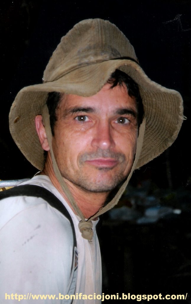
MR. JEAN PAUL SOUNIER (FRENCH CAVER)
Team Leader,Canyawa 2002 Expeditions
The French Caving Expedition Team
175 Chemin de Beauvert 06600 Antibes
Email: Sounier@club-internet.fr

MR. JONI A. BONIFACIO (FILIPINO CAVER)
Trexplore The Adventures
Abesamis Store Allen Ave. Catbalogan,Samar
TEL: 055-2512301 CELL: 09192943865
Email: trexplore@yahoo.com
Website: www.bonifaciojoni.blogspot.com
CAVING EXPEDITION TEAM:
1.Jean-Paul Sounier (leader and photographer/French Caver)
2.Philippe Audra (karst specialist/French Caver)
3.Paul Courbon (surveyor/French Caver)
4.David Hiou You (equipment coordinator/French Caver)
5.Catherine Caullier (French Caver)
6.Christine Le Roch (French Caver)
7.Laurent Jovet (French Caver)
8.Philippe Hache (French Caver)
9.William Michel (French Caver)
10.Luc Ruyssens (French Caver)
11.Joni Bonifacio (Trexplore/Filipino Caver)


CANYAWA CAVING EXPEDITION 2002
Page 1 of 11
CAN-YAWA 2002 EXPEDITION REPORT
WESTERN & EASTERN SAMAR ; SAMAR ISLAND, PHILIPPINES
March 10th – April 28th 2002
This report includes results from SURIBAO 2000 caving expedition
EXPEDITION MEMBERS
Jean-Paul Sounier (leader and photographer)
Philippe Audra (karst specialist)
Paul Courbon (surveyor)
David Hiou You (equipment coordinator)
Catherine Caullier
Christine Le Roch
Laurent Jovet
Philippe Hache
William Michel
Luc Ruyssens
Joni Bonifacio
Written by Administrator
Monday, 21 March 2005
Page 2 of 111. EXPEDITION OBJECTIVES
The expedition main objective was the carrying out of the exploration of Can-Yawa cave, and above all, the active part. The visit of other objectives spotted on the map were depending upon the results in Can-Yawa cave. In case of important discoveries in Can-Yawa, all the team energy would be spent in exploring its new parts.
In Can-Yawa cave, the streamway was the most promising objective. The underground river could lead us to the resurgence, but also enable us to join the underground course of the Mactingal river, probably the main drain of the plateau. The second objective in Can-Yawa was to be able to find a way past the boulders choke in « No Future » chamber.
The objectives spotted on the map were :
· The sinkhole of a river located 4 km, south-southeast from Can-Yawa cave. This underground river could re-appear in Kulindungan, the name of the Calbiga spring. It would mark the southern limit of the catchment area.
· A dry valley located above the extreme point reached in Can-Yawa streamway. A cave located in the western part of this valley could communicate with Can-Yawa underground river, downstream the sump. The path used by the Elf Authentic Adventure runners follows this dry valley.
· The western end of a dry valley located 3 km north from Can-Yawa entrance. This dry valley could be an ancient bed of the Mactingal river. The valley heads west and ends as a blind valley.
· The sinkhole of the Mactingal river. Several Italian expeditions tried to reach it but without success due to the NPA based on the western flank of the karstic area. To reach it was doubly interesting. The importance of the catchment area and stories about a 200 m large entrance porch let supposed a huge underground network. To have a look of the area could also enable us to find an objective for a future expedition.
Several scenarios were dreamed up in order to reach these objectives and carrying out at the same time the exploration of Can-Yawa. Set up the camp at the same place as two years before and walk from it, the access at the Mactingal sinkhole being on the surface of the plateau. In case we could connect Can-Yawa to the Mactingal underground course, the exploration could be done by establishing underground camp. Or, move the camp from Can-Yawa to the bank of the Mactingal river. This scenario meant an important portage at mid-stay. But what happen really was different from the above planning.
CHRONOLOGY OF THE EXPEDITION
March 10th Departure from France on March 10th with Lufthansa Airlines that we should like to thank for allowing an 8 kg per person excess weight.
From March 13th to March 15th : organising the trip in Tacloban. Arrival of Joni Bonifacio.
March 16th travel in jeepney from Tacloban to Borongan, Eastern Samar.
March 17th Pompei comes to visit us; we all go to see Borongan Mayor.
March 18th With Abdel Elecho, we go to see the Mayor who signs the official authorizations. Then we go to Pompei’s office then to the DENR. At 9.30 am, we go to Camada. Trip up the Suribao river to Bagong Barrio, with stop-off in Pamaragsangan to see the military commander and Binuangna to change bancas.
March 19th departure from Bagong Barrio at 9.15 am. The team and 44 porters reach San Isidro at 4.30 pm.
March 20th departure from San Isidro at 9.30 am. The bamboo zone located west of Mount Asgad slows down progress as the path has been swallowed by the thick vegetation. We set up a bivouac near a river.
March 21st departure at 7 am. We reached the Suribao expedition camping site at 11 am. Set up of the camp.
March 22nd it rains heavily. Can-Yawa river is flooding. We carry on the setting of the camp.
March 23rd the whole team go to Can-Yawa. But the short cut has to be clear up again. So a part of the team visits the cave, while the others cut the track back to the camp.
March 24th exploration of downstream Can-Yawa. We stop on a waterfall due to lack of rope.TSU (Time Spent Underground) : 9h.
March 25th David, Laurent and Cathy carry on the exploration downstream. They reach a big chamber and stop when the gallery roof seems to plunge in the water. On the way back, the river is flooding and they have to fight their way out.TSU : 12h.
March 26th Luc, Christine, Philippe and Jean-Paul go to the « No Future » chamber area. They find a way past the rockfall at the end of « No Future » and explore a large gallery (Return to the Future ). Siphon and rockfall stop the progress in this branch which could lead to a western entrance, north from Day cave. In the Rotten Feet river, they stop on a low ceiling gallery.TSU : 15h.
March 27th David and Paul cut a trail towards the southern river.
March 28th Laurent, Cathy and Roderic cut a trail towards the Northern tributary. Paul, David and Jean-Paul explore Can-Yawa downstream. They stop on a sump. They explore a dry tributary on the right bank of the « Clue ».TSU : 11h.
March 29th Luc, Laurent, Cathy and Joni reach the Northern tributary, upstream its sinkhole. Exploration of Jolo cave.TSU : 1h.
March 30th Luc, Philippe and Jean-Paul go to the Northern tributary and reach the San Isidro-Kaamlongan trail.David, Cathy, Paul and Joni cut the trail to the Southern river.Roni and Roderic go to Bagong Barrio to call the porters for the departure of three of us.
March 31st Laurent, Luc and Christine survey Jolo cave. Return of the group who cut the southwards trail. They didn’t reach the river yet.TSU : 2h.
April 1st Cathy and Philippe go to the Northern tributary for sampling. Laurent, Christine, Luc and Jean-Paul check some caves openings located near the track going to San Isidro. They are located southeast from the camp. The caves turn out to be parts of old cave systems which are destroyed by erosion.
April 2nd Laurent, Cathy and David leave the camp. Philippe, Christine and Jean-Paul go to the area located above Can-Yawa sump to look for caves in the hope to find a way downstream the sump.TSU : 2 h.
April 3rd rest.
April 4th Philippe, Paul, Christine and Jean-Paul go to the Southern river and reach the sinkhole area. They explore 3 caves. Back to the camp at 2 am the next day.TSU : 4 h.
April 5th arrival of Philippe Hache and William Michel.
April 6th Philippe Hache, William and Jean-Paul go to check the end of the dry valley located north from Can-Yawa cave. They reach the end of the dry valley at 4.30 pm but no caves are found.Paul and Philippe go to the big chamber, downstream the “Clue”, and find a new entrance (Elfes cave). They return to the camp through the Mog-Ur.
April 7th Philippe, Willy and Jean-Paul are back to the camp.
April 8th departure of Philippe Audra and Roni who carry one of his bag.
April 9th Willy, Philippe, Luc, Christine, Joni and Jean-Paul go to Can-Yawa for the photo trip. They decide to go through the Anguish tunnel and are surprised by the low level of water. The surprise is at its utmost when they discover a tributary on the right bank of the tunnel, just before the Verdon. They explore about 1 km of galleries. They name this network the tributary of the Last Day. No survey is made because nobody took the gear. The photo trip is made until the « Clue ». William and Philippe go to see the sump.TSU : 13 h.
April 10th departure of the team. It rains all the way long. The team reach San Isidro at 4.30 pm.
April 11th Roni and Roderic guide the team to the sinkhole of the Minaalo river, located northwest from San Isidro. Quick visit of the cave.TSU : 2 h.
April 12th Willy, Luc, Joni and Jean-Paul explore Minaalo cave and traverse the mountain.TSU : 2 h
April 13th Willy, Joni, Jean-Paul and 3 porters including Antonio, San Isidro barangay captain, go to the Mactingal sinkhole. They walk 5 hours and reach Mactingal river.
April 14th Willy, Joni and Jean-Paul visit several Mactingal sinkholes and explore Mactingal cave. Two local farmers guide them.TSU : 2h30.Philippe, Christine, Luc and Paul survey Minaalo cave and explore the beginning of the tributary.TSU : 9h.
April 15th guided by the two local farmers, Willy, Joni and Jean-Paul explore Ninando cave, located northeast from the main Mactingal sinkhole.TSU : 4h30.Luc, Philippe and Paul explore and survey the tributary in Minaalo cave.TSU 7 h.
April 16th Willy, Joni, Jean-Paul and the 3 porters are back to the camp.
April 17th Luc and Paul survey in Minaalo cave.TSU : 5 h.
April 18th Roni and Roderic go to San Isidro to organize the return trip. Philippe, Christine, Joni, Willy and Jean-Paul realize a photo trip in Minaalo. They survey a part of the tributary river.TSU : 6 h.
April 19th return of team to Bagong Barrio. Departure from Minaalo at 7.30 am. Arrival in Bagong Barrio at 6 pm.
April 20th return to Borongan.
April 21st – 22nd : rest in Borongan . Visit to the DENR and the Mayor.
April 23rd return to Tacloban.
April 24th stay in Tacloban.
April 25th Philippe, Christine and Jean-Paul spend the day and the night in Marabut. Luc, Willy, Joni and Paul go to Rawis to survey Rawis cave.TSU : 10h.
April 26th return from Marabut and Rawis.
April 27th departure of Christine, Willy, Luc and Paul to France.
April 28th departure of Philippe and Jean-Paul to France.
LUNGIB CAN-YAWA UPSTREAM N°2 - CAN-YAWA UPSTREAM N°2 CAVE
Area : Calbiga karst
Surveyed length : 184 m
Vertical range : 2 m
Map : Calbiga ; N° 4054 IV ; 1/50000.
Coordinates : not computed. Its position is near Can-Yawa upstream N° 1 cave downstream entrance.
DESCRIPTION :
A unique tube of which size is more or less constant forms the cave : its average height is 20 m and its width varies from 10 to 20 m. The cave turns on the left and traverses a small piton. There is a dry loop on the right bank, which is 60 m long and is, in fact, a stooping oxbow of the main passage.
LUNGIB CAN-YAWA - GROTTE DU DIABLE - DEVIL’S CAVE
Area : Calbiga karst
Surveyed length : 11700 m
Total explored length : 13000 m
Vertical range : 114 m ( + 50 m ; - 64 m)
Map : Calbiga ; N° 4054 IV ; 1/50000.
Coordinates (from map reading) : X = 125° 09.794’/ Y = 11° 32.863’.
DESCRIPTION:
1 - Entrance, main gallery and gallery of Oblivion
Located at the bottom of a high cliff, the cave entrance is 5 m wide by 2 to 3 m high. On February, the cave was exhaling during the day. Tree trunks cluster up the entrance. Slippery boulders form the floor at the entrance. The gallery widens. 120 m from the entrance, a river comes out from a gallery located on the right side : it is the gallery of Oblivion. This gallery is of smaller size. In many places, it is necessary to wade or swim through pools. It will be dangerous to be here in case of flood. The gallery of Oblivion measures 655 m. The river which flows in the gallery of Oblivion is formed by the surface river which sinks a few hundred metres before the cave entrance, but also by the river which disappears in the downstream sump of Can-Yawa Upstream N° 1 cave ( see “surface and underground drainages” sketch).
Back to the main gallery which heads mainly northwest. The size of the gallery is about 15 m wide by 8 to 10 m high. The river must be crossed a few times, but progression is mainly on the banks of the river. After 500 m from the cave entrance, we reached an important junction, but between the entrance and this junction, a few galleries branched out from the main one. They are : Belzebuth’s lair and Fantasy gallery which will be described in the Northern tributary paragraph.
2- Belzebuth’s lair
This gallery is located on the left bank. A muddy slope leads to the entrance, which measures 1 m wide by 3 m high. It widens to a 2 to 4 m and 4 to 5 m high muddy gallery, which turns on the left, then on a right until it gets bigger. A gallery 6 to 10 m wide by 8 to 10 m high leads to a chamber 40 m wide and 15-18 m high. Well-decorated side passages branch out from that chamber. Belzebuth’s lair is 272 m long.
3 - The tunnel of Anguish
Back to the junction ; there, the river flows into a gallery which section size decreases. Galleries branch out from the right bank ; they lead to the Northern tributary. The riverway sizes down to 8 m wide by 3 to 4 m high. The gradient decreases, so the river invades the whole width of the tube. Without a canoe, it is necessary to swim. The current is quite strong in some places ; it would be impossible to swim back in case of flood. The gallery meanders through the rock with a very regular section ( 8 m wide and a roof at 3 m from the water surface). Three inlets are located on the left side of the tunnel. After 445 m, the gallery widens. On the left, a boulders slope indicates the way to an upper gallery. It leads to the junction with a non-active gallery, of which description is given in the next paragraph. Downstream, we stand at the beginning of the “Verdon”.
4 - The “Last Day” tributary
On the last day of the stay in Can-Yawa camp, during the 2002 trip, a tributary was found at the end of the Tunnel of Anguish”, on its right bank. It was explored for around 1 km but not surveyed, as the purpose of the underground trip was to take photos of the newly discovered part of Can-Yawa cave. The survey of this tributary will be an objective for the next expedition.
5 - The dry gallery between the junction and the Verdon
At the junction, a steep slope made of rocks and mud leads to a large gallery which turns on the right and increases in size, forming a chamber where there is 2 possibilities ; on the right, a gallery marks the beginning of the Northern tributary (see description below). Northward, a gentle slope leads to a huge and very well decorated passage, but with a muddy floor. In places, the gallery widens forming chambers (Bonia room). Then a slope leads down to the “Verdon”, just downstream the tunnel of Anguish. This passage bypasses the dangerous tunnel of Anguish, which must be submerged in case of flood. In the middle of the dry passage, a gallery goes down to the tunnel of Anguish.
6 - Azraël’s gallery
This 80 m long gallery starts at the top of the slope leading from the stream to the dry passage. A short climb is necessary to get to the gallery which heads mainly southeast. The passage measures 1 to 2 m wide and 5 to 7 m high with a stalactites decorated ceiling. At the end, the passage widens to 8 m wide by 10 m high.
7 - The Northern tributary
The gallery, large at the beginning, dwindles in size to an 8 to 12 m wide by 6 to 8 m high tunnel with a decorated ceiling and a floor a bit muddy, punctuated with small pools. At 60 m from the beginning of the series, a shaft on the floor goes down to the streamway. At 100 m and on the right, a 97 m long gallery describes a loop that ends by a window on the right wall of the main passage, upstream the start of the tunnel of Anguish. The gallery, named Fantasy gallery, is 6 to 8 m wide by 4 to 5 m high with a stalactites decorated ceiling. At 130 m from the start of the Northern tributary, a gallery on the left slopes down back to the tunnel of Anguish. The length of this loop is 40 m. The cave continues by a gallery heading east-northeast. The size and the direction of this passage change constantly. The width varies from 2 to 15 m and the height from 1 to 10 m. A few tight passages separate larger sections. Apart of pools, the gallery is dry but must be flowing in period of floods. The river flows below and, in two places, it is possible to climb down small shafts to reach the water level. The river cannot be followed downstream because the streamway becomes too tight. Upstream, the dry gallery narrows to a short crawling passage. But then we reach a big chamber, Devil’s Horns chamber. The river flows on one side of the room (right as we walk upstream). A huge scree fills up the rest and climbing up boulders leads to a well decorated upper parts of the room. Upstream, the river flows in a 15 m wide by 15 to 20 m high gallery, which dwindles in size to a 4 by 4 m passages. But on the left as we go upstream, a huge room rises up to the surface of the plateau. The entrance measures 13 m wide by 6 m high and is located on one side of a doline flanked by steep pitons. At + 50 m from the main entrance altitude level, it is the highest point of the system. The room named “Bastos and Tequila “ chamber is 50 m wide and is boulder floored. Many side galleries join the streamway to the chamber. Upstream the chamber, the river flows in a gallery 4 m by 4 m but then a passage on the left rises up again to the surface, but not as high as the previous chamber : this is the Mog-ur cave. The gradient streamway eases down to zero. A lake fills up the 10 m wide gallery but a sump stops any progress further up. The Northern tributary network is 955 m long.
8 - The Verdon
The gallery named “Verdon” is a huge vadose tube, which measures from 10 to 25 m wide by 10 to 35 m high. In many places, flowstones add a beautiful note to this wonderful streamway. The river flows with a succession of lake, rapids and small waterfalls. In two places, the tube dwindles in size (15 m wide and 8 m high). Between these two smaller sections, there is an enlargement measuring 70 m long for 38 m in width at the largest point. Just before the first narrowing, a slope going up leads to a big upper gallery, which ends in a boulder choke. There are beautiful white stalactites in a corner of the gallery that, because of the important width, forms a chamber. The Verdon can be followed for nearly one kilometre to a widening where start different branches.
On the right, a steep, muddy-floor passage ends on 2 leads too tight to be followed. It seems that, in one, there is a small gallery that could go on, but a climb is necessary to get to it. At the top of the slope, a 2 m long snake skeleton has been found.
In a northwest direction, the river flows in a tunnel that has been partially explored and surveyed. We feared flood, so we agreed to explore that part on a next trip. Anyway, the dry gallery of the Fakir bypasses the active passage, for 235 m in a straight line.
On the left, in a southwest direction, a steep ascent gives access to the gallery of the Fakir.
9 - Gallery of the Fakir
Beautiful dripstones and flowstones decorate the top of the slope. Downstream, the gallery is huge in size and meanders through the mountains. In places, flowing water is heard below, but access to it needs climbing down. The rocky floor shows sharp and twisted shapes, hence its name, due to the erosion. The gallery of the Fakir ends where we reach the streamway. A 3 m drop leads to the normal water level. The river emerges from a tunnel which is parallel to the Fakir tunnel, but at a lower altitude. Downstream, two parallel galleries absorb the river. It is easier to wade along the wall of the right one. Then the galleries merge. It is necessary to cross the river at that point, from right to left bank. But if the water level is high, the crossing is tricky. Then there are two possibilities : to follow the streamway, or to leave the active level and climb to the dry one, in “Once upon a time to the West” gallery.
10 - The streamway and Elfes’cave
Downstream, the gallery takes a rectangular section for 70 m and half that distance is non-active as the river describes a loop, which has not been explored. A sloping gallery leads to the river, but it is possible to progress downstream in a non-active loop on the left bank. Flowstone decorates this passage which is muddy in places. A stream emerges from a small inlet. The river flows in a gallery that becomes higher. Two calcite pillars decorate a chamber left bank : Tanios’ pillar. Downstream, the gallery has a keyhole section, 4 to 5 m wide at the bottom, 25 to 30 m high, and a width of 10 to 15 m at the top. The river flows with high speed. It is impossible to wade in the water when the flow rate is important. Keeping on the wall is compulsory in such situation. But when the flow is low, it is possible to progress on banks or ledges until a lake. The walls are vertical, so swimming is the way to go further. With high water, it is impossible to swim back. The lake is around 20 m long. Then the slope increases and the river rushes down. Crossings of the river enables to progress without fixing up ropes along the wall, but it is wise to rig the river crossings. The slope becomes vertical and the river rushes down in a waterfall. A tiny ledge on the right bank required fix rope to allow the progression. In place, the passage is quite difficult. A small abseil ends downstream the waterfall which is followed by a deep pool and a second waterfall. The passage above the cascade is on the right bank wall where a ledge needs also to be rigged with fixed ropes. All this section of rapids, waterfalls and lake since Tanios’ pillar has been named “La Clue”. A huge chamber (100 x 60 x 60 m) follows. Downstream the chamber, the river enters a gallery 10 x 10 m. This gallery can be followed for 115 m until it divides in three parallel branches. The river deepens. The roof plunges in the water and one gets the feeling that this is the siphon. In fact, on the right branch, a small gallery starts at right angle and leads to a low roof chamber. A lake occupies the northern part of the chamber. By swimming, it is possible to pass a short low roof passage. The gallery which follows heads south-westwards but after 250 m, the cave ends in a large siphon at –64 m from the cave entrance.
On the summit of the boulders scree which occupies the right bank of the chamber named “Thierry Saint-Dizier chamber”, a windy passage can be follow. It narrows and starts ascending. A squeeze was enlarged. Then the narrow passage ends in a room which communicates with the outside. The cave has been named “Elfes’cave” due to its proximity with trail used by the Elf Authentic Adventure participants in 1999.
On the right bank of the clue, a climb gives access to a large ledge. A gallery starts in a direction perpendicular to the clue. It can be followed for 104 m and narrows until a calcite choke.
11 - “Once upon a time to the West” gallery
The gallery named “Once upon a time to the West” is an amazing tube that can be followed for 2500 m. Its dimensions are quite regular : about 10 to 35 m in width by 8 to 30 m in height. Its ceiling is almost everywhere decorated with stalactites : millions of stalactites! The gallery meanders through the mountains in a direction mainly west, so its name. The gallery starts where we leave the river and ends up in Shelob’s lair. In fact, hydro-geologically, the gallery ends up at Day cave. A lot of galleries branch out from the main tube, and we will describe them in following paragraphs.
We leave the river by a steep rise. At the beginning, the huge tunnel heads southwest, but then it is going to meander through the rock in a direction mainly west. It will be boring to describe the “Once upon a time to the West” gallery as it is quite similar all along its kilometres : stalactites decorated arch-like ceiling, width and height always important, muddy floor, stalagmites and calcite pillars in a lot of spots, beautiful lakes in places. We are just going to give information concerning typical places.
At 180 m from the beginning of the passage, the floor is very muddy. Water drops falling from the ceiling have formed thousand of funnel-shaped holes. The mud stick to the shoes and the passage has been named : the Carabao pit.
130 m further away, the daylight can be seen from a small hole in the roof of the gallery. To get out by this pitch requires artificial climbing and has not been try during the expedition. The shaft has been named : the Cauldron valve. It was considered as a possible escape way from the cave in case of flood, all the beginning of the cave being flooded to the roof after heavy rains. 30 m downstream and on the left, there is a chamber where we thought we could find an access to get out. No one was found. Then the gallery diminishes in size and turns sharply on the right. A lake is crossed by swimming. A left turn, and the dimensions increase again. On the left wall, a beautiful flowstone can be climbed up. At the top, two small leads have not been followed. For the next 700 m the “Once upon a time to the West“ gallery is huge. Lakes, stalagmites cluster and beautiful gours decorate the passage.
1100 m from the point we leave the river, there is a Y-junction. The right branch is the obvious one that we tend to follow. It leads to the “No Future” chamber; see the description in the next paragraph.
It is necessary to climb up a muddy slope to get to the next part of “Once upon a time to the West “ gallery. The passage turns on the right and diminishes slightly in size. Water trickles down from the roof and flows down beautiful gours. Two leads on the right have not been explored. This place has been named: “K” chamber.
A 67 m long gallery joins the K junction to the “No Future” chamber.
90 m downstream the K chamber, we reach a Y-junction; on the right the gallery leads to the river of the Rotten Feet (see below). On the left, a muddy slope, called “Back to the mud”, gives access to downstream “Once upon a time to the West“ gallery. After heading southwest and south, the big tube turns right, heading again west. It divides in two parallel tunnels. In the corner of the bend, the gallery of Wonders starts (see below).
The huge tunnel can be followed for 500 m before opening into “Shelob’s lair”. Shelob’s lair is a widening of the main passage, but it is also an important knot as five galleries branch out from it. Shelob’s lair is at -36 m from the entrance altitude level.
12 - The “No Future” chamber and the active gallery
When following the “Once upon a time to the West” gallery, it is easy, at first, to miss the right passage leading to the main continuation of the cave. This is because the passage is on the left, hardly visible at the top of a muddy slope. On the contrary, straight ahead, the gallery goes on, huge. Soon, big columns join the roof to the floor of the tube and we have to find a way through them. Once this beautiful passage over, we enter the “No Future” chamber. It measures 50 m wide by 12 to 18 m high. But as we go on ascending over boulders, rocks falls from the ceiling have accumulated to the point where there is 3 m left between floor and ceiling. The chamber ends on a boulder choke. On the right, a climb down a rocky slope leads to a gallery which size diminishes. A stream emerges from the right and disappears into a very small outlet, too narrow to be followed.
13 - The “Return to the Future” gallery
A narrow passage at the very end of the active gallery mentioned here above was not seen during the 2000 expedition. The squeeze gives access to a gallery of which sizes increase quickly. The passage goes up and leads to a large gallery which is in fact the same as “No Future” but downstream the rocks choke. Amazingly white flowstones decorate the beginning of the huge tube which can be followed for 250 m. Unfortunately, an other rocks choke bars the gallery. A small passage leads to an active gallery which ends on a siphon. The ‘Return to the Future” passage measures 419 m.
14 - The gallery and the river of the Rotten Feet
90 m downstream from “K” chamber, there is a Y-junction. On the left is “Back to the mud” which is part of “Once upon a time to the West” gallery. On the right, a 15 m wide by 8 to 18 m high gallery begins. It heads in a northwest direction. Calcite pillars decorate it in a few spots. After 155 m, the easy walking passage seems to end. In fact, a 3 m wide by 1.5 m high gallery follows. 13 m further, it divides in three small leads. The one on the right is narrow and has not been explored. The one in the middle has been followed but not surveyed. A stream emerges and follows this passage. The gallery on the left dwindles in size to a 2 m wide by 1 m high squeeze, then emerges in a wide but low passage (20 m wide and 1.5 m high). This low-roofed passage can be followed upstream and downstream. Downstream, the passage keeps the same section but the width decreases to 10 m. 75 m downstream, the junction is made with the streamway, which has been named “the river of the Rotten Feet”. There, the section of the passage changes and it leads to a small chamber of which floor is formed by collapsed boulders. The river disappears under a scree. From the chamber, a gallery goes down to the river level. The river can be followed for a few metres but then it flows in a crawlway too small for a caver. Upstream, the low-roofed passage can be followed for 45 m. It opens into a chamber 50 m long, 25 m wide and 14 m high. But a scree fills up most of the chamber surface, and there are only 2 to 3 m left between the top of the rock pile and the chamber ceiling. A small passage leads from the top of the chamber to the “Once upon a time to the West” gallery. From the bottom of the chamber, a 10 m wide by 5 m high well decorated walking passage leads to “Once upon a time to the West” gallery after 55 m.
15 - Wonders gallery
The Wonders series branches out from “Once upon a time to the West” gallery where it describes a bend, from south to west. The Wonders series heads east-northeast. A climb is necessary to get access to the 270 m long gallery. During the whole length of the passage, it is an incredibly beautiful display of white dripstones : stalactites, stalagmites, flowstones, pools fill up with crystals, the gallery deserves well the name we gave it. The gallery ends on a calcite choke. The gallery of Wonders is, without any doubt, the most beautiful of the cave.
16 - Gallery of Bosom
The gallery of Bosoms starts from the southern side of Shelob’s lair. To reach the gallery, it is necessary to climb a 20 m steep slope. The gallery is 86 m long. Its dimensions are 15 m wide by 18 m high at the beginning but the size dwindles in size until the end, which is blocked by dripstones. The ceiling is well decorated and, towards the end of the gallery, the stalactites look like woman breasts, hence the name of the gallery.
17 - Gallery of the Cornflakes
On the west side of Shelob’s lair and at the same level as the gallery of Bosoms, starts the gallery of the Cornflakes. To get to it, we have to follow the way that leads to the gallery of Bosoms, then follow a ledge cluttered with stalagmites in order to find the entrance hidden behind columns and high stalagmites. The gallery is 158 m long and averages 10 to 25 m wide by 8 to 15 m high. The floor goes up and down. Everywhere stalagmites and columns spring up towards the ceiling. A few calcite pillars tumbled down ages ago and clutter up the floor where we have to meander our way among the stalagmites forest. The formations show a palm-like structure. Unfortunately, as we go along, our steps break a few formations on the floor and when they break, the sound is like the one of cornflakes being chewed, hence the name of the passage. The Cornflakes gallery is one of the most beautiful of Can-Yawa cave. It ends up on a boulder choke, but it seems there is a lead, which could reach after a not very easy climb.
18 - Galleries between Shelob’s Lair and Day cave
The main passage heads northwest. Dimensions remain important. The gallery turns at right angle on the left and heads southwest. At 350 m from Shelob’s lair, a T-junction is reached. A fault has enabled a gallery to be formed in a north-south direction. Moreover, it is necessary to chimney down a crack to reach the bottom of the north-south passage. On the left, a long and beautiful gallery ( 5 to 10 m wide by 5 to 10 m high) goes back to Shelob’s lair. On the right, the passage widens and a chamber (20 m wide, 6 m high) follows. The gallery goes on northwest for 80 m then turns westward and gives access to a chamber where boulders clutter the left part. At the top of the scree, the stalagmites, which have grown on the rocks, are dry. On the south side of the chamber, rocks and dry soil block a few small leads. It seems as if the surface is very near. In fact by keeping on the right side of the chamber, a 12 m wide by 12 m high gallery gives access to the outside at the west entrance of Can-Yawa caves system. This entrance has been named “Day cave”. On the left before getting outside, a small gallery goes up to a second, but smaller, entrance, the sixth of the system. The length of the traverse, from Can-Yawa entrance to Day cave measures 5200 m. Day cave is at – 47 m from the main entrance altitude level. A depth of – 50 m is reached at a low point in the gallery, upstream Day cave entrance.
LUNGIB LAMOC – GOUFFRE DES AOUTATS - GNAT CAVE
Area : Calbiga karst
Surveyed length : 133 m
Total explored length : 150 m
Vertical range : 45 m
Map : Calbiga ; N° 4054 IV ; 1/50000.
Coordinates : X = 125° 11.1’/ Y = 11° 33.9’
DESCRIPTION :
The cave starts with a 40 m pitch with several ledges. The rock is very brittle in the upper part of the pitch. The pitch comes out in a large gallery. Upstream, it leads after 32 m to a lake. An ascending slope does not give access to further passages. Downstream, the gallery widens but a lake stops the progression. This lake is in fact a sump. Two upstream galleries end also on this lake but they both stop on narrow passages. The cave depth is 45 m. Unfortunately, this vertical cave well located in relation to Can-Yawa system does not give access to it, downstream the sump.
P20
Area : Calbiga karst
Estimated total explored length : 20 m
Estimated vertical range : 20 m
Map : Calbiga ; N° 4054 IV ; 1/50000.
Coordinates : imprecise
DESCRIPTION :
The shaft is located on the left side of the Elf trail (San Isidro-Kaamlongan path) when going westward. It is at the end of the large doline, before the start of the climb to the plateau. The entrance measures one metre in diameter with a rock jammed across.
The cave is formed by a single pitch with two narrow ledges. It continues with a meander which is quickly plugged. There is no air draft. The wall are crumbly due to the quality of the rock, a limestone with flints, and the important corrosion.
CAVE (unnamed- located close to the Elf race trail)
Area : Calbiga karst
Estimated total explored length : 80 m
Estimated vertical range : 10 m
Map : Calbiga ; N° 4054 IV ; 1/50000.
Coordinates : imprecise
DESCRIPTION :
The entrance of this cave is near the Elf trail (San Isidro-Kaamlongan path), a few hundred metres after having reached the limestone. The trail passes along the entrance, which has been formed by the collapse of the gallery roof. We have to climb down 2 metres to reach the floor of the gallery. Southward, the gallery is quite straight, but two climbs are necessary to reach the end. Northwards, we must climb down a rockfall in order to reach the floor of the gallery. The gallery describes two hairpin bends, one on the left, one on the right, before ending in a chamber.
The cave is known by the locals who have visited it completely. Stalactites plundering has not occurred, due probably to the location far away from villages or roads. The untouched calcite formations proved that the locals people plundered caves not by pleasure or pure vandalism, but when there is the possibility of making money out of it.
The position in altitude of this cave compared with the gallery of Gnats cave. It corresponds to an old drainage level which is now 50 metres above the active level, the Can-Yawa river which flows just below.
LUNGIB JOLO – GROTTE JOLO - JOLO CAVE
Area : Calbiga karst
Surveyed length : 127 m
Total explored length : 127 m
Vertical range : 18 m
Map : Calbiga ; N° 4054 IV ; 1/50000.
Coordinates : X = 125° 09.800’/ Y = 11° 13.800’
DESCRIPTION :
Jolo cave has been found during the cutting of the track joining Can-Yawa base camp to the Mog-Ur entrance. We thought it will be an easy access to the Elf track. The name of the cave is formed by the first syllable of the two finders’ name, Joni and Laurent, nicknamed Lolo.
The cave is located half way between Can-Yawa base camp and the Mog-Ur entrance. The surface area is broken up by big dolines. In one, a large porch can be seen. The large entrance seems to end on a calcite curtain, but a narrow passage between the formation give access to a large and well decorated gallery. The gallery is 110 m long and ends on a calcite choke. The cave shelters sparrow birds.
LUNGIB NINANDO – GROTTE NINANDO - NINANDO CAVE
Area : Calbiga karst
Surveyed length : 500 m
Total explored length : 500 m
Vertical range : 84 m ( + 1 m ; - 83 m)
Map : Calbiga ; N° 4054 IV ; 1/50000.
Coordinates : undetermined (no GPS reading due to forest cover)
DESCRIPTION :
The entrance porch is located on the south slope of a vast depression which has not been positioned on the map with precision. The cave network heads southwest. It stars with a huge chamber: 150x50x40 m. The roof has a regular curved shape. The floor is not at all flat. We must climb down a steep scree to reach a flat floor at -12 m, then climb a scree to go back at the same altitude than the entrance porch (+ 1 m exactly). A boulders slope then leads to a flat floor at – 32 m. A short climb leads to a chaotic well decorated chamber: calcite pillars, stalagmites, flowstones. The south-western side of this chamber is occupied by a huge block under which we must pass to reach a passage 1 m wide. We enter a complex of decorated chambers. On the right, a gallery leads to – 63 m, but it is plugged with clay. On the left, another chamber follows. A narrow passage in a calcite barrier enables to enter a gallery which leads to a junction. Above is a low roof chamber. Below, the cave continues with a pitch. It is possible to climb down between walls and boulders a steep slope without rigging it with ropes. The pitch ends on a narrow passage which absorbs water drops. The depth is – 83 m.
LUNGIB MACTINGAL – GROTTE MACTINGAL - MACTINGAL CAVE
Area : Calbiga karst
Surveyed length : m
Total explored length : 324 m
Vertical range : 23 m
Map : Calbiga ; N° 4054 IV ; 1/50000.
Coordinates : undetermined (no GPS reading due to forest cover)
DESCRIPTION :
Due to a thick forest cover, the entrance cave has not been located with precision. The GPS could not read because of the thick forest cover. The cave is located more or less to the northwest of the Mactingal river sinkhole, which is shown on the map. The cave starts with a small entrance nearly plugged with a tree trunk. A shaft leads to a tiny upper entrance. A short wall can be climbed down. We are at a junction. On the right, the gallery widens and separates in two branches. On the right, a short gallery comes out on the steep wall of a doline. On the left, the gallery describes a “S”, then comes out at the bottom of the same doline. On the northern side of the doline, a small and short gallery leads to a sump, at – 17 m.
Back at the bottom of the climb. The left branch is a gallery which increases in size and leads to a pitch which can be climbed down. At the bottom, the gallery continues and gets bigger and bigger (up to 15 m wide). Unfortunately, it ends up on a large sump, at – 23 m. A steep slope can be climbed up on the right. It leads to – 4 m, where the sizes of the gallery decrease until an impenetrable passage.
GROTTE DE L’EGOUT – SEWER CAVE
Area : Calbiga karst
Surveyed length : not surveyed
Total explored length : around 300 m
Vertical range : not surveyed
Map : Calbiga ; N° 4054 IV ; 1/50000.
Coordinates : undetermined (no GPS reading due to forest cover)
DESCRIPTION :
This cave is the sinkhole of the overflow of the river located south of Can-Yawa river. As we did not know its local name, we called it Southern river. It is a maze of small galleries occupied in place with lakes. Because of the strong draft, we hoped a junction with underground Southern river, but it was only due to a shaft joining the surface. The explored length is around 300 m.
LUNGIB MALAGAY– GROTTE DE LA BOUE – MALAGAY CAVE
Area : Calbiga karst
Surveyed length : 540 m
Vertical range : 20 m
Map : Calbiga ; N° 4054 IV ; 1/50000.
Coordinates : X = 125° 08.778’/ Y = 11° 30.784’.
Altitude : 235 m
DESCRIPTION :
Three and a half kilometres south of Can-Yawa cave, we had spotted on the map a river, parallel to Can-Yawa river, which sinks at the contact with the limestone plateau. We hoped that the underground course will lead northwest to the Calbiga spring. Two days where necessary to cut the way towards the river. A 17 hours trip enables us to reach the sinkholes area and explore three caves.
Numerous waterfalls and rapids slowed down the progression to the sinkholes. When we got there, we were disappointed by the first sinkholes which is impenetrable. A dry overflow lead us to a second sinkhole. Instead of a big cave, we explored about 300 m of small passages invaded with pools. This cave, Sewer cave, ended on a sump. It has not been mapped due to lack of time.
200 m before Sewer cave, on the left bank, Philippe discovered another cave which acts as an overflow sinkhole. A passage through boulders gives access to a chamber after an easy climb down. A gallery going down leads to a stream. Upstream, we followed the stream for 100 m. It ends on an impenetrable crack where the water emerges. On the right, we climbed a muddy slope to reach a low roof gallery ( 4 m wide for 1.5 m high). The floor is muddy. We are in an area which is underwater when flooding. 200 m further upstream, the whole width of the gallery is occupied by water. The roof is at an average 1 m above the water surface. The lake is about 1.2 m deep. Walls and roof are smeared with mud. After 200 m of progression in this lake where the floor gets muddier and muddier, the cave ends on a sump. Due to the omnipresence of mud, we named the cave, Malagay cave. Malagay means mud in the Waray language. The cave has been explored and mapped for 540 m in length.
CAVE (located near the southern path)
The “Southern river” sinks in Sewer cave. A couple of metres before and on the left bank, a path climbs up and leads to a succession of dolines oriented Southwest. The path heads towards the villages located at 2 km. It goes through a pass, at an altitude of 300 m. Half way between the sinkhole and the pass, a cave opens near the trail. A 10 m wide gallery follows. It is 100 m long and calcite pillars clutter up the passages. The gallery ends on a calcite choke. Near the entrance porch, a chimney opens up on the surface above. Bats live in the cave which is known by locals.
6.3. MATINGKAD KARST
LUNGIB MINAALO- MINAALO CAVE
Area : Matingkad karst
Surveyed length : 3 075 m
Vertical range : 45 m (+ 40 m, - 5 m)
Map : Calbiga ; N° 4054 IV ; 1/50000.
Coordinates : X = 125° 13.737’/ Y = 11° 32.254’.
Altitude : 315 m
DESCRIPTION :
Four kilometres northwest from the village of San Isidro, the Minaalo river sinks in the northern flank of the beautiful Matingkad mountain.
The river flows through the mountain in a gallery eight to ten metres wide for ten to twenty metres high. It emerges after 1.7 km underground and junctions with a tributary of the Suribao river.
1 - The main drain
During the 2002 explorations, the river had a low flow rate, estimated at 0.5 m3/s. The river bed shows a low sloping gradient. It is composed of mud and pebbles. The progression is very easy all along the river which meanders through the mountain.
At 300 m from the entrance, the river disappears in a sump. But on the right, a passage leads to a big chamber with a huge boulders scree. A 20 m high climb up the boulders leads to the top of the scree. 40 m higher up, an unreachable chimney starts towards the unknown.
After this chamber, we find again the river which emerges from the sump. We progress with water up to the waist for the next 200 m. The stalactites decorated roof goes down to 2 m from the water surface. This passage must be very dangerous when flooding.
100 m after the low passage, the gallery widens. Beautiful stalactites decorate the high ceiling. This large gallery ( 10 to 12 m wide for 15 m high) goes on. After 800 m of easy progression, we reach the Western tributary which starts with a chamber. 350 m more, and we reach a Y junction. The south western branch goes out after 60 m. It must be an overflow of the main river.
Beyond that junction, the wide gallery goes on in a south east direction. After 300 m, and for 100 m in length, the roof shelters thousands of bats. The noise is incredible. After 1600 m of easy progression, we reach a doline, named the Green Snake doline. The rivers flows under a boulders scree, and we have to climb up and down to reach the river at the entrance of another underground tunnel. The 20 m high gallery measures 80 m long and emerges on the western flanks of the Matingkad mountain.
2 –The Western Tributary
The Western tributary starts in a big chamber, on the right bank of the main drain. At the western end of the room, a little stream comes out a beautiful but small gallery ( 1 to 4 m wide for an average 2 m high). After 200 m, we reach a widening clutters up with rocks, with three openings to the surface. To the west, we enter a wide gallery which is followed by a vast boulders-strewn floor room. We have not succeeded in finding a lead out of this rock choked chamber. This chamber has been named : Disappointment room.
A couple of metres before the entrance of Disappointment room, an active tributary has been followed until a squeeze invaded with water. All along, the gallery (1 to 2 m wide), is partly obstructed with stalactites. This tributary has been named: Boredom tributary.
West from the above-mentioned openings, a gallery heading east starts. This rocks-strewn active gallery ends 200 m further east in a sump. The stream emerges at the entrance of the Western tributary.
3075 m of passages have been surveyed in Minaalo cave.
6.4. RAWIS KARSTIC AREA
LUNGIB RAWIS – RAWIS CAVE
Area : Rawis karst
Surveyed length : 1 740 m
Vertical range : 68 m
DESCRIPTION :
This well known cave is located near the village of Rawis, on the shore of the Basey river. It takes two hours to reach Rawis from Tacloban. The cave is at 20 minutes walk from the village. A part of the team went there at Joni’s request. He wanted us to survey the cave.
Despite the fact the cave is well known and is visited by guided groups, the cave formations are undamaged. It is probably due to the guide respect to the cave, a good prospect, considering the plundering of Langun and Gobingob caves system.
The main cave entrance is located at the foot of a cliff. A 5 by 4 m gallery leads after 200 m to a chamber lighted by the daylight coming down through two openings. Boulders clutter up the floor. Many parts are decorated. The cave carries on with a huge gallery, 25 m wide in places. This gallery is 400 m long and is well decorated. It has been named: gallery of the Philippinos Shapes. The gallery ends in a chamber which opens up on the surface. Two smaller galleries start from this chamber. Their length is 100 m each.
A northern system starts from the Philippinos Shapes gallery. Its length is 500 m. This galleries network is not as big as the first part of the cave and not as easy to go through. It ends by two openings. A southern system starts also from the Philippinos Shapes gallery. The gallery leads to a 15 m pitch which marks the end of our exploration and survey.
The total surveyed length is 1740 m.
Amazing virgin cave system found in Samar
Source: Manila Bulletin
Author: Edmer F. Panesa
Date: 2002-04-05
The Department of Environment and Natural Resources (DENR) has predicted that the recent discovery of French cave hunters of a virgin cave system in Samar would boost the region’s eco-tourism program as well as generate more jobs for the people living in the area.
DENR Secretary Heherson T. Alvarez said there are raised expectations that the find would actually match or even surpass the beauty and grandeur of the world-renowed St. Paul’s subterranean underground river and cave system in Palawan, which has been an ecotourism staple.
“This discovery is a most promising study in Samar where the largest limestone area in the Philippines is found. I am very optimistic that it could usher in new developments and promote environmental awareness in the area,” Alvarez said.
He added that like the Palawan system, this virgin cave system in Samar would attract thousands of tourists and provide revenue for the local government.
The French team, headed by Jean Paul Sounier, began its second phase exploration on the Suribao Cave System particularly the Can-Yawa (Devil’s River) Cave in Borongan, Eastern Samar last March 21 until April 26. The team first explored the area in February 2000.
The expedition aims to study the connection of two limestone plateau rivers to the Calbiga River and explore resurgence on the lower part of the Suribao River, Alvarez said.
The French team found out that the Calbiga River has a “huge yet undiscovered underground system,” which covers more than 50 kilometers.
The environment chief said the DENR would continue to protect and preserve the whole area as mandated by the National Caves and Cave Resources Management and Protection Act.
“The Can-Yawa Cave as well as the other caves surrounding it offers a magnificent site to behold. It has been the policy of the present administration to protect such resources that show the wealth of our country’s natural resources,” said Alvarez.
posted by Trexplore at 8:48 PM
![]()

0 Comments:
Post a Comment
<< Home